elistechnology
Well-Known Member

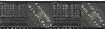
In central Europe we got this.
Waypoint mission:

Poly or rectangular mission:

Time calculated in mission plan: 10 min, time in air: 15 min, timer stops on each of turns (mapping, not counting fly to start and home)
Last time the job that takes max 10h depending on wind with P4RTK on lower speed and ALT, with AUTEL took me almost 14 hours with higer speed and ALT.
Without stopping on each waypoint i could create mission that follows terrain, now it would take days to fly (for example 300 waypoints for 10ha in one mission x 20 missions)
Parrot in Anafi drone solve same problem pretty fast, Yuneec also dealt with it somehow. Now i read that "older" version of this drone does not have this issue.