Welcome, Autel Pilots!
Join our free Autel drone community today!
Join Us

EVO RTK Map Process with 4 GCPs and 2 CHECKPOINTS

I don't process in Drone Deploy or Pix4D. But in Metashape, you have options that should, in theory, result in the same output. If the drone uses WGS84 exclusively, that makes sense and is a good thing. @elistechnology mentioned he thought that the WGS84 elipsoid model on the drone may be off, which is not good but if true could probably be fixed easily with FW.
When I read that, it was kind of alarming to me. But as you said, should be easily fixed if true.

I am still unclear on the whole Evo 2 RTK workflow.

What is your NTRIP using? WGS84 or NAD83(2011)? I assume that if Evo 2 RTK outputs in WGS84, doesn't it need the input corrections to be WGS 84?

Are the elevations in your images and control points ellipsoid or orthometric heights?

Off topic, but can you use an Emlid RS2 as a base station set on a known point and send corrections to the Evo 2 RTK using the LoRa radio?
 
Options are a mixed bag. They are great when you know what to specify. But if you don't, they can bite you. MS is used for so much more than terrestrial modeling which leads to more options. Pix4D is more streamlined making it more user friendly. But I don't think it is superior by any means. And they are very proud of the software, if you know what I mean.

Most of my work is for construction sites- project management and inspections.

It's great that your are working on providing relatively accurate AND referenced data when relative accuracy is really all that is needed by your clients. Surveyors want both, so you'll be ready!
 
  • Like
Reactions: jaja6009
When I read that, it was kind of alarming to me. But as you said, should be easily fixed if true.

I am still unclear on the whole Evo 2 RTK workflow.

What is your NTRIP using? WGS84 or NAD83(2011)? I assume that if Evo 2 RTK outputs in WGS84, doesn't it need the input corrections to be WGS 84?

Are the elevations in your images and control points ellipsoid or orthometric heights?

Off topic, but can you use an Emlid RS2 as a base station set on a known point and send corrections to the Evo 2 RTK using the LoRa radio?
The NTRIP here in vegas is not set to a certain datum, it works with all datums. when I survey with the RS2 I pick which datum to use and it works, when the drone wants WGS84 then it works. Images are is WGS 84 ellipsoid, Points are in State plain geoid. I can set the receiver to do everything in WGS84 Ellipsoid.
The RS2 can send corrections to the drone, not through Lora (because the drone can not receive Lora radio) But the RS2 can be set up as a caster and send its own NTRIP correction to the drone while receiving corrections from NTRIP.
I have not found a way to make a known point with RS2 and have it send state plain corrections to the drone.
 
My work that involves DEM accuracy is for surveyors and engineers. They don't care about the orthomosaic at all except for a reference. All they typically want is the surface mesh as accurate as possible.


It this screen grab provided by @elistechnology you can see where he is telling MS that the GCP is expected to be 10x more accurate than the camera positions. MS processes accordingly.

View attachment 11901
You are spot on with my outputs. I am reprocessing again in WGS84 and also with the GCP and Images given different weights for their accuracy.
I am also assuming that the elevations (714 -740) are now WGS 84 ellipsoid values? That's how I am processing them right now.
 
  • Like
Reactions: jmason702
Options are a mixed bag. They are great when you know what to specify. But if you don't, they can bite you. MS is used for so much more than terrestrial modeling which leads to more options. Pix4D is more streamlined making it more user friendly. But I don't think it is superior by any means. And they are very proud of the software, if you know what I mean.


It's great that your are working on providing relatively accurate AND referenced data when relative accuracy is really all that is needed by your clients. Surveyors want both, so you'll be ready!
I am using Pix4D right now because I won a year long subscription for Pix4D Mapper, Pix4D Matic and Pix4D Survey. $10,000 worth of software until March 22.

I will most likely be going with Agi MS, as Pix4D does not offer local Geoids, and I find that most people want their data in what they can relate to. And for the city I work for it is NAVD88 Geoid 18.
While I can get Pix4D to give orthometric heights in that, it adds to my workflow.

I agree 100% that Agi MS is the superior product. I wish I had more coin as I would really like to have Agi MS, Pix4D Mapper and Reality Capture as I have found each has something I like about it and I do love to do comparisons as much as possible.


JMason, thanks for letting me use your data, as I have really been wondering about the Evo 2 RTK. I really want to see a Phantom 4 Pro vs Evo 2 map comparison as equal as possible. I want to see the quality of the map in regards to density of the cloud and other factors. I have a hunch that the Evo 2 may win that one as I have read that Autel does a better job with their JPEG creation.
 
You are spot on with my outputs. I am reprocessing again in WGS84 and also with the GCP and Images given different weights for their accuracy.
I am also assuming that the elevations (714 -740) are now WGS 84 ellipsoid values? That's how I am processing them right now.
My point were pulled in State plain, NAD88 Geoid vertical Datum, The drones points are in WGS84, Can you convert my points to WGS84 using PIX?
 
I am using Pix4D right now because I won a year long subscription for Pix4D Mapper, Pix4D Matic and Pix4D Survey. $10,000 worth of software until March 22.

I will most likely be going with Agi MS, as Pix4D does not offer local Geoids, and I find that most people want their data in what they can relate to. And for the city I work for it is NAVD88 Geoid 18.
While I can get Pix4D to give orthometric heights in that, it adds to my workflow.

I agree 100% that Agi MS is the superior product. I wish I had more coin as I would really like to have Agi MS, Pix4D Mapper and Reality Capture as I have found each has something I like about it and I do love to do comparisons as much as possible.


JMason, thanks for letting me use your data, as I have really been wondering about the Evo 2 RTK. I really want to see a Phantom 4 Pro vs Evo 2 map comparison as equal as possible. I want to see the quality of the map in regards to density of the cloud and other factors. I have a hunch that the Evo 2 may win that one as I have read that Autel does a better job with their JPEG creation.
I have a Phantom 4 V2 NON-rtk, and I like the EVOs outputs a lot more than the phantom.
 
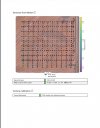
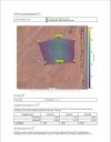
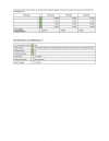
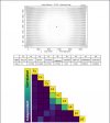
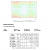
The report, all in WGS84 Ellipsoid 4-GCPs and 2-CPs
 

Attachments

  • 84-1.jpg
    84-1.jpg
    304 KB · Views: 5
  • 84-2.jpg
    84-2.jpg
    352.1 KB · Views: 5
  • 84-3.jpg
    84-3.jpg
    159.3 KB · Views: 5
I didn't work in DroneDeploy :/
"Camera Calibration 0% variation from reference intrisics"
Is there an option to calibrate cameras basing on GCPs (not use precalibration)?
 
in DD the closer to 0% the better it is, if that makes sense.... Hence the green tag by it means Good
If things were not good, it would have a orange or red tag next to it. DDs is very simplified
 
I didn't work in DroneDeploy :/
"Camera Calibration 0% variation from reference intrisics"
Is there an option to calibrate cameras basing on GCPs (not use precalibration)?
your thoughts on the accuracy of the DD report?
 
Can you process again using MAX0001-MAX0234 images only?
"It looks like you did everything right, but next time you fly a location like this I would recommend disabling “enhanced 3D” when capturing the data. This mode is designed for buildings and structures, and as a result will lower your accuracy in terrain type scenes."
 
  • Like
Reactions: jmason702
Pasting points coordinates in WGS84 that i used for processing to be sure that we work on same data:
1,-115.217601,36.00308014,714.298
2,-115.2172625,36.0031074,713.906
3,-115.2169202,36.00311587,713.501
4,-115.2169195,36.00352983,712.808
5,-115.2172869,36.00359028,713.305
6,-115.2177631,36.00348732,714.107
 
Can you process again using MAX0001-MAX0234 images only?
"It looks like you did everything right, but next time you fly a location like this I would recommend disabling “enhanced 3D” when capturing the data. This mode is designed for buildings and structures, and as a result will lower your accuracy in terrain type scenes."
they took that feature away, there use to be terrain mode and structure mode. Now there is just one
 
GCP Label,Northing,Easting,Elevation (ft)
1,36.003080,-115.217601,742.236388
checkpoint2,36.003107,-115.217263,741.845938
3,36.003116,-115.216920,741.440858
4,36.003530,-115.216920,740.747741
checkpoint5,36.003590,-115.217287,741.243957
6,36.003487,-115.217763,742.044668
 
I deleted images, saved 1 - 234, copied and pasted your coords. just to make sure.
In DD you have to upload Northing, Easting, or it wont accept it.
I will reprocess. it might not be till morning. as I got to bed early to go out of town for work in the morning
 

Latest threads

Members online

No members online now.

Forum statistics

Threads
11,280
Messages
102,952
Members
9,878
Latest member
Elio-Italy