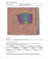
Riddle me this, Your input please? @Blade Strike and everyone else, This was a well-flown map.
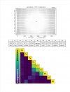
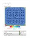
I am processing the same map without checks...
I am processing the same map without checks...
DroneDeploy
www.dronedeploy.com
Attachments
-
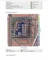
 Screenshot 2021-10-09 080441.jpg225.9 KB · Views: 41
 -
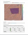
 Screenshot 2021-10-09 080901.jpg183.4 KB · Views: 38
 -
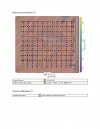
 Screenshot 2021-10-09 080820.jpg370.6 KB · Views: 36
 -
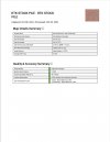
 Screenshot 2021-10-09 080744.jpg323.7 KB · Views: 35
 -
 Screenshot 2021-10-09 080634.jpg314.8 KB · Views: 35
 -
 Screenshot 2021-10-09 080548.jpg339.7 KB · Views: 36