Welcome, Autel Pilots!
Join our free Autel drone community today!
Join Us

Best Practices to Connect an Emlid Reach RS2 Base to an Autel Evo II Pro Enterprise RTK Drone

Malli35998

Well-Known Member
Joined
May 9, 2021
Messages
292
Reaction score
152
Age
68
Location
Kingwood, TX
Website
www.raptoraerialservices.com
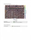
I normally use an Autel Evo II Pro Enterprise RTK Drone, EOS Arrow Gold RTK GNSS Receiver and GCPs for my mapping projects. I borrowed a colleague's new Emlid Reach RS2 Base and tried it out for the first time today. The base does not have a cellular sim card so I was reliant on using my iOS mobile devices as a hotspot in order to get an internet connection. Making all of the pieces work together was a challenge. I decided to place the Reach Base over one of my GCPs that I determined the location with my EOS Arrow Gold RTK GNSS Receiver using the TopNet Live RTK corrections service. One of the problems I ran into early on was that the Emlid Reach RS2 Base sat on top of a BOSCH Aluminum Heavy Duty Elevator Quick Clamp Tripod (BT300). It had no level and no easy way to align the base over the center of the GCP. I eye balled it the best I could. I also surveyed in a couple of check points but used no GCPs. Using my iPhone hotspot I was able to connect to both the Emlid Reach RS2 Base and Autel Smart Controller. Also, I used the EMLID CASTER site to pass NTRIP corrections between the base and the drone using the same mount point. I was able to get a FIX solution on both the base and the drone during the entire survey.

I flew the 45 acre survey and everything seemed to go smoothly. I processed the survey shortly thereafter. It processed quickly with no issues. Flight lines were perfect as best I could tell. The resulting 2D Ortho and elevations models looked very good. Since I had flown a drone survey using GCPs earlier, I have a good base to compare the survey to. Looking at the new data closely, I noticed a slight (about a foot or so) horizontal shift in the data to the east compared to the earlier drone survey I flew. That didn't both me too much since I had trouble aligning Reach base over the GCP (known point). The bigger problem I had was that the elevation data was way off. From 50-100 ft difference from the earlier RTK survey I flew. I am not sure exactly what happened here. Since I chose Manual as the Base mode, I may not have input the height correctly since I placed the antenna and EOS Arrow Gold receiver directly on the center of the GCP to record the ellipsoid height of the known point. Probably a dumb idea.

I chalk this up to a learning exercise. I would be very interested in your feedback and any suggestions/best practices you have to successfully connect an Emlid Reach RS2 Base to an Autel Evo II Pro Enterprise RTK Drone and get good results.
 
A couple observations/questions:

What program (and settings) did you use for post processing? I recently did a test project, post processed in Pix4d using the "Accurate Geolocation and Orientation" calibration method. It seemed to have major elevation issues- almost like the scale was off/exagerated. When processing with "Standard" or "Alternative" calibration everything seemed fine. This leads me to believe something may be off with the EXIF tags from the E2E.

Regarding the base station, obviously 'eyeballing' the setup over a point isn't optimal. A tribrach with an optical plumb, or just a string and stone, would help.

But one trick to eliminate these issues would be to focus on the spatial location of the base station rather than the ground location. In other words, just rely on the RS2 antenna location by entering a rod height of zero. The disadvantage here is repeatability, but it can eliminate errors due to rod leveling or human error entering coordinates.

This is especially important for PPK projects- the ground location of the base station doesn't matter, it is the antenna phase center that should be the reference point.

Along those lines, assuming you had logging autostart on the RS2, you could PPK your project and see if you get better results.
Thanks for the quick response.

I used SimActive's Correlator3D for post processing. I will check to see if there is similar functionality in Correlator3D.

I spoke with my colleague who owns the Bosch tripod. He can add both a bubble level and a plumb line if needed. I also have a different tripod setup that may work better.

I selected Manual as the Base mode and input the coordinates like the known point was a benchmark located on the ground. Do you still need to enter the rod height of zero in this case?

I am not sure if I had logging autostart on the RS2. I will check. I have never done PPK. Perhaps time to learn.
 
I selected Manual as the Base mode and input the coordinates like the known point was a benchmark located on the ground. Do you still need to enter the rod height of zero in this case?
No- in that case you if you're entering coordinates you need to compensate for rod height.

I'd recommend using the the auto-base feature on the RS2- average your fixed position for several minutes. Again, eliminates pole or human errors.

Another thing that occurs to me is that your known point might not have been in WGS84, ellipsoid heights.
 
the EVO records data in ellipsoid elevation, that's why your see the difference in elevation. is your emlid receiving corrections from NTRIP?
 
I have done many tests with the RS2 sending corrections to the EVO via emlid caster with great success. But I am always receiving corrections from NTRIP to the RS2 then to the EVO
 
I can upload a 50 Acer map using multiple batteries if you would like to run it through your software to see the results, no GCPs. just Emlid receiving corrections from the NTRIP station and sending them to the drone.
 
the EVO records data in ellipsoid elevation, that's why your see the difference in elevation. is your emlid receiving corrections from NTRIP?
That was mostly the issue. Once I added a correction/adjustment between ellipsoid and ortho height in post processing, that solved most of the difference. Thx
 
  • Like
Reactions: jmason702
A few more questions …

1. In the ReachView 3 app, Under Status overview, why does the Position state -95.xxxxxx deg E? “W”?

2. When positioning the RS2 Base, and absolute accuracy is required, is it better to use Manual (input fixed lat, long and ellipsoid height) or use Average Fix for Base mode?

3. When using Manual mode and inputting antenna height, do you include the height from the ground to the base of the RS2 or do you include the height from the ground to the base of the RS2 plus 134mm. For example, if the antenna height from the ground to the base of the RS2 receiver is 2.15265 meters, do I input 2.15265 meters or (2.15265 +.134)= 2.28665 meters?
 
Last edited:
2. When positioning the RS2 Base, and absolute accuracy is required, is it more better to use Manual (input fixed lat, long and ellipsoid height) or use Average Fix for Base mode?
I use ave fix with NTRIP, if you dont have NRTP then I would use manual over a known point
 
3. When using Manual mode and inputting antenna height, do you include the height from the ground to the base of the RS2 or do you include the height from the ground to the base of the RS2 plus 134mm. For example, if the antenna height from the ground to the base of the RS2 receiver is 2.15265 meters, do I input 2.15265 meters or (2.15265 +.134)= 2.28665 meters?
I use a 2-meter pole and add the 134mm to that for the height of the RS2
 
I feel I am getting to the point I don't need GCPs, just 2 or 3 CPs to check accuracy

here is an accurate report of a 50 Acer map, just one example
 

Attachments

  • DD.jpg
    DD.jpg
    359.6 KB · Views: 29
Z= .96 inch

We have run many tests against checkpoints and ave. 2 to 4 cm.
 

Latest threads

Members online

Forum statistics

Threads
11,227
Messages
102,648
Members
9,818
Latest member
redwingaerials