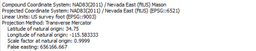
I think your problem (guess) is that you were using 6521 (State Plane Projected Coordinate System) along with NAVD88 using meters instead of us ft in Agisoft. And if you were using Geoid 12 that most likely differed too.
You use Drone Deploy, so I see why you want and need your elevations in orthometric instead of ellipsoid. I only use Drone Deploy for a project I want to mass share or to test something. I actually find Drone Deploy harder to use than Agisoft. Agisoft for me is so easy. Tell it what you want to output in, tell it what your drone images are in and tell it what your markers are in. It does the rest and is so flexible. For this reason I chose it over Pix4D mapper. Pix4D matic though does have local geoid support and undulation grids (The geoidal height so that you can use H=h-N on each drone image coordinates).
On code 6318 in Emlid. Just use the default GCS setting. NAD83(2011) (6318) is a global coordinate system just like WGS84. If you lay them over top of each other they match (for our intents and purposes). They only differ in where they think the center of the earth is at the current time and have a shift. With a Rover receiving corrections, it receives whatever GCS is sent to it by the Base. Example: You are receving RTN NTRIP in NAD 83 2011, your RS2 is now in NAD83 2011. You averaged a point with your RS2 from your NTRIP and are now sending corrections to your drone, your RS2 is sending NAD83 2011 and your drone is receiving NAD 83 2011.
Here is a link for adding Geoid 18:
How to use height above geoid for the coordinate system
You could do this:
1. Obtain your known point - Receive NTRIP and average on your RS2. You now have a known point in NAD83 (2011) with ellipsoid elevations.
2. Setup your RS2 as your base now. Enter the averaged coordinates and ellipsoid height in Manual. You can now output NAD 83 (2011) with ellipsoid heights over Emlid Caster and your drone will now receive that.
3. Get your RS+ setup as your Rover. Use the default GCS setting and ellipsoid heights. Your RS+ is now receiving NAD83 (2011) and ellipsoid height.
4. Gather your Control Points.
5. Fly your mission.
You now have: drone images in NAD83 (2011) and ellipsoid heights and Control Points in NAD83(2011) with ellipsoid heights
This data works great in Agisoft, but you will need orthometric heights for Drone Deploy unless you use GCPs.
Load the images into Agisoft and export from the Reference Pane into a csv.
Visit NGS Geoid 18 Computational Tool and use the multiple files tool on the bottom. This tool needs just the coordinates in the desired format (see the instructions).
It will produce a list of the geoid undulation or geoidal height for each coordinate given.
copy and paste this into the original csv in a new column. Make a new column where you will make an orthometric height column. Use H=h-N or Orthometric Height = ellipsoid height - geoid undulation (what you received from the Geoid 18 Tool).
That new colum now has orthometric heights.
Use a metadata editing tool and change all of your images altitudes to the new orthometric heights. Upload to Drone Deploy.