I'm not sure that I can put your mind at ease, but I'll share my experience over the last few weeks.
Fairly small sample size, but in each of the four mapping missions that I've completed, the RTK has disconnected at least once. I've only actually processed the images (Pix4d) from one flight. The results were serviceable.
To answer your specific questions:
1a. I can connect and get a fix from our state CORS network. Format is RTCM v3.2.
2a. I have not specifically used this workflow for mapping, maybe I'll try it this week.
1b. My typical workflow involves setting an Emlid Reach RS2 at a known point (via its own network connection), and connecting it to the Evo Smart Controller via the EmlidCaster option.
2b. Using this connection, the geotags are read by Pix4d as Lat Long with 8 decimal digits, and altitude (m) with three decimal digits. O/P/K and image accuracy are also read by Pix4d.
I've documented the PPK workflow
here. Results seemed pretty good (within a couple centimeters of the fixed status RTK data). In PPK, you loose antenna offset (which is easy enough to manually change), and lever arm calculations (assuming Autel actually implemented this in their RTK to EXIF process).
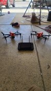
Was planning to document this elsewhere, but since you are a prospective buyer, I'll list some pros and cons of the E2E here.
Pros:
- It's not made by DJI
- Automatic geotagging via EXIF
- Decent camera specs
- Decent images mapping on "auto mode" (clearly this is a huge no-no, but I tried it anyway just for fun)
- Decent battery life
Cons:
- Finicky NTRIP formatting/requirements limit base station choices see here.
- RTK disconnects - I still need to diagnose this more, but it is very troubling. Note that hitting 'disconnect' and 'login' reestablished corrections.
- Speed/overlap limitations: best I could achieve seemed to be 10 m/s, 84% overlap at 120m. I'd like this to be higher, particularly at something like 60m agl.
- The vehicle burns a bunch of time turning around at the end of transects. It's like- slow down, stop, think, turn, go slow, turn, think, then accelerate on the next line. This is probably related to maintaining GNSS fix, but it is really annoying.
- Mission planning is unpleasant on the Smart Controller
- Rolling shutter (really no longer an issue when using Pix4d).
- Lack of support
- A bunch of stuff unrelated to mapping:
- "Enterprise" accessories are silly
- Carrying case is a joke. A very bulky and heavy joke.
- Panorama features
- Auto ("smart") flight features don't seem as good as Parrot or 3DR, but this is not my area of expertise
- Smart Controller can't be charged during flight
- Smart Controller button customization doesn't seem to work
I really can't say if price is a pro or con. It seems high for me, having worked on better spec systems from a DIY approach. So I had high hopes that the E2E would be smooth and polished professional solution. I don't believe that this to be true. However, I'm not aware of other off the shelf systems that would be cheaper for mapping.
Hope that was at least a little helpful, happy to expound on further questions. Good luck!