Welcome, Autel Pilots!
Join our free Autel drone community today!
Join Us

Doing Manual Coords on the RS2

jmason702

Well-Known Member
Joined
Aug 30, 2020
Messages
1,023
Reaction score
341
Age
46
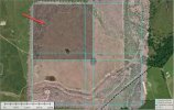
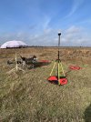
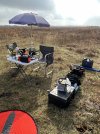
I got a job coming up out of my county, and they are going to give me a control point. I was looking at the manual input on the reach view 3 app.

and says LAT, LONG, and Elevation (ellipsoid, meters only) So I guess I need to tell them I need elevation in Ellipsoid? and is there anything else I should know?

Every Surveyor I know works in NAD 83 Geoid.

Thanks guys
 
Last edited:
So what would you do if you showed up for a job with a known point established on site and it's in NAD 83 2011, and Geoid Elevation?
Is there a good app calculator, that you could put the LAT / LONG in and come up with the Geoid or Ellipsoid height?
 
  • Like
Reactions: jmason702
I carry 2 GNSS RTK Receivers, the Emlid Reach RS2+ and EOS Arrow Gold. With the Arrow Gold and using their EOS Tools Pro App, you can measure Ellipsoid, Ortho Height (Geoid 12b), and MSL heights. If I am using a know point, I measure Lat-Long-Elevation with both GNSS receivers on 2m survey staffs.
 
  • Like
Reactions: jmason702
So I am correct, to put in coords manually into the RS2, it has to be an ellipsoid elevation in meters correct?
 

Confirm with the surveyor that he is using NAD83 2011. Then confirm that he is using NAVD88 AND what geoid, 12 or 18.

Confirm if the elevation is orthometric or ellipsoidal

If Orthometric do the following:

Orthometric elevation is: H (Orthometric) = h (ellipsoid elevation) - N (Geoid elevation)

So if the orthometric elevation is (example) 2, H=2

2 = h - N

We can now use an NGS tool to obtain N or the height of the geoid at that coordinate.

Visit: GEOID12B - GEOID - Data XXXXXTITLEXXXXXamp; Imagery - National Geodetic Survey
This is for Geoid 12

This is for Geoid 18

Input your Nad83 2011 coordinates into the tool and you will now get the height of the geoid at that coordinate: N
For this pure example lets assume the geoid elevation you get is -34.000

We now have enough to solve to get the ellipsoid height.

2 = h - (-34.00)

So 2 + (-34.00) is how we would solve.

h = -32.00

Elipsoid height is -32 meters.
 
Last edited:
I am shooting a large thermal IR survey over a portion of the Hockley Salt Dome NW of Houston. The total area is between 500-600 acres. I have divided the survey into 4 overlapping sections. See screen capture below. The drone surveys are rotated 45 deg to account for wind direction. Wind speed is a consistent 5-10 mph with higher gusts. Given the parameters to acquire thermal IR, it will take about 4 days to complete. I have completed one, 149 acre section. The next 2 photos show my setup in the field. I am using the Autel EVO II Dual FLIR 640R Radiometric Thermal camera attached to one my Autel Evo 2 6K Pro Enterprise V2 RTK drones. For RTK, I am using the Emlid Reach RS2+ GNSS RTK receiver setup with Local NTRIP Output mode and Manual Base Mode. The remaining 2 attached screen captures show flight lines representing nearly 9600 images. This survey required 12 battery changes to complete this section. The flight line data is not edited. What impresses me is the stability and consistency of the data. There are a few dropped images but not too many. More later.
 

Attachments

  • 2023-01-18_7-33-51.jpg
    2023-01-18_7-33-51.jpg
    293.3 KB · Views: 13
  • IMG_5218.JPG
    IMG_5218.JPG
    3.2 MB · Views: 12
  • IMG_5216.JPG
    IMG_5216.JPG
    2.6 MB · Views: 11
  • 2023-01-18_6-50-16.jpg
    2023-01-18_6-50-16.jpg
    185.6 KB · Views: 11
  • 2023-01-18_6-50-32.jpg
    2023-01-18_6-50-32.jpg
    46.7 KB · Views: 11
Last edited:
I am shooting a large thermal IR survey over a portion of the Hockley Salt Dome NW of Houston. The total area is between 500-600 acres. I have divided the survey into 4 overlapping sections. See screen capture below. The drone surveys are rotated 45 deg to account for wind direction. Wind speed is a consistent 5-10 mph with higher gusts. Given the parameters to acquire thermal IR, it will take about 4 days to complete. I have completed one, 149 acre section. The next 2 photos show my setup in the field. I am using the Autel EVO II Dual FLIR 640R Radiometric Thermal camera attached to one my Autel Evo 2 6K Pro Enterprise V2 RTK drones. For RTK, I am using the Emlid Reach RS2+ GNSS RTK receiver setup with Local NTRIP Output mode and Manual Base Mode. The remaining 2 attached screen captures show flight lines representing nearly 9600 images. This survey required 12 battery changes to complete this section. The flight line data is not edited. What impresses me is the stability and consistency of the data. There are a few dropped images but not too many. More later.
VERY COOL
 
If you don't mind, can you explain how the Local NTRP works? I have always used regular NTRIP with internet but had issues on my last mission out of town where the wifi was sketchy, and I don't see any you tube videos on it.

Thanks
 
If you don't mind, can you explain how the Local NTRP works? I have always used regular NTRIP with internet but had issues on my last mission out of town where the wifi was sketchy, and I don't see any you tube videos on it.

Thanks
Local NTRIP works like this.

You setup your base on a known point. This point could be a survey benchmark, a point you made in OPUS or PPK or a point you averaged with RTN (NTRIP or VRS).

Use a wifi hotspot and then connect your Evo 2 RTK Controller and your base to this wifi. Corrections are now sent over wifi. The range is limited and you must have controller, wifi hotspot and base in close proximity (10-20 feet, but I never tested it for range really).
 
  • Like
Reactions: jmason702
I am shooting a large thermal IR survey over a portion of the Hockley Salt Dome NW of Houston. The total area is between 500-600 acres. I have divided the survey into 4 overlapping sections. See screen capture below. The drone surveys are rotated 45 deg to account for wind direction. Wind speed is a consistent 5-10 mph with higher gusts. Given the parameters to acquire thermal IR, it will take about 4 days to complete. I have completed one, 149 acre section. The next 2 photos show my setup in the field. I am using the Autel EVO II Dual FLIR 640R Radiometric Thermal camera attached to one my Autel Evo 2 6K Pro Enterprise V2 RTK drones. For RTK, I am using the Emlid Reach RS2+ GNSS RTK receiver setup with Local NTRIP Output mode and Manual Base Mode. The remaining 2 attached screen captures show flight lines representing nearly 9600 images. This survey required 12 battery changes to complete this section. The flight line data is not edited. What impresses me is the stability and consistency of the data. There are a few dropped images but not too many. More later.

LOL, I have a lot of the same gear. I like your control points though, mine are snap type garage tiles in checkboard pattern and are awkward to carry.

Are you setup on an NGS survey monument or did you OPUS or PPK where you set the base?
 
Emlid support says they solved you Emlid caster problems. What did it turn out to be?
It resolved on their own. It may come back. I tried telling them that I have been using the Caster for over a year with no problems. Nothing has changed, my hotspot is remembered and it was so easy to connect. I would turn on the RS2, turn on my hotspot and the RS2 would connect to the wifi. Connect my phone to wifi, put Base Corrections to Output NTRIP, my Mount Point credentials are prepopulated. Bam, I am outputting corrections.

It just will not connect on some days. there is no ryhme or reason to it. When it doesn't work it will not work on any internet connection.

He posted that to give closure, but I have a feeling it will come back since it came out of nowhere and resolved on its own out of nowhere and has happened once before.

A guess out of left field is maybe the electromagnetic energy bursts we have been getting hit with in this elevated sun spot cycle is messing with the internet somewhere along the line. I have no idea where the servers are for Emlid. I guess this off the wall guess because I cannot think of any other possible reason as I have ruled them all out except to test with my RS+ next time as the Base.
 

Latest threads

Members online

Forum statistics

Threads
11,292
Messages
103,024
Members
9,903
Latest member
Aerugo