- Joined
- Mar 10, 2022
- Messages
- 3
- Reaction score
- 0
- Age
- 78
I've created a terrain-following photogrammetry mission with a flight height (altitude) of 325 feet AGL in UgCS and loaded it to Autel Explorer on the V2 remote controller.
The mission file format is "As a line string" and "Relative to the ground under the 1st waypoint"
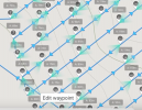
Explorer accepts the file and displays the waypoints and flight track.
Instead of flight altitudes of 325 feet AGL, the waypoint elevations increase to more than 500 AGL
Any ideas on how to correct the waypoint altitudes?
Because altitudes in the mission are greater than 400 feet, Explorer will not fly the drone.


