Welcome, Autel Pilots!
Join our free Autel drone community today!
Join Us

Evo 2 altitude calculation

steve2497

Well-Known Member
Joined
Feb 9, 2021
Messages
92
Reaction score
52
Age
48
I flew a mission earlier this evening with numerous waypoints. I set the altitude to 180 feet for all waypoint and return to home set also at 180 feet to keep everything consistent.

The problem was by time it got to one of the furthest away waypoints it was only circa 50-80 feet above actual ground level. What caused this was the land gradient sloped upwards causing a steady decrease in actual drone height. As the ground level increased the drone did not sense this and adjust its height accordingly.

As far as I am aware you can't tell the slope of the land through a standard top down satellite view so I am relying on the drone to adjust its height so it is always at the height I specify.

So my question is have I missed something and how does the Evo calculate its real-time height - I would have thought it would sense the ground getting higher and adjust its height to compensate but clearly this has not happened.

Any thoughts or advice?
 
  • Like
Reactions: Sjs
I flew a mission earlier this evening with numerous waypoints. I set the altitude to 180 feet for all waypoint and return to home set also at 180 feet to keep everything consistent.

The problem was by time it got to one of the furthest away waypoints it was only circa 50-80 feet above actual ground level. What caused this was the land gradient sloped upwards causing a steady decrease in actual drone height. As the ground level increased the drone did not sense this and adjust its height accordingly.

As far as I am aware you can't tell the slope of the land through a standard top down satellite view so I am relying on the drone to adjust its height so it is always at the height I specify.

So my question is have I missed something and how does the Evo calculate its real-time height - I would have thought it would sense the ground getting higher and adjust its height to compensate but clearly this has not happened.

Any thoughts or advice?
To the best of my knowledge (I'm a relatively new drone pilot):

I believe the altitude displayed in the explorer app (AGL altitude) is altitude above takeoff point and to compensate - as of the latest firmware update you have the ability to enter altitudes as either AGL or MSL in the mission planner. Using MSL altitudes in the mission planner waypoints sounds like it would be a good idea in your scenario.
Disclaimer: Please don't take this as gospel - as I'm not an experienced pilot yet (although I got my part 107 with a 97% passing score). ?
If what I'm saying is wrong - I hope a better more experienced pilot will scold me and present the correct information. ?
 
Thank you, would be good to get other opinions, I always fly in AGL, so is MSL likely to fix this?

I have read somewhere in this forum that it displays height above take off point only, is this true?
 
I t
Thank you, would be good to get other opinions, I always fly in AGL, so is MSL likely to fix this?

I have read somewhere in this forum that it displays height above take off point only, is this true?
I think the reason they put MSL waypoint altitude specification in the mission editor is that so if your takeoff point/altitude changes (i.e. between flights/missions) - then each mission waypoint altitude specified in MSL will not change. So for the first mission you would calculate the MSL from the takeoff point for each waypoint. Then, if you flew the mission again from a different takeoff point/altitude the drone would be at the same altitude for each waypoint for each flight - regardless of takeoff point/altitude. Does that make sense?
 
Last edited:
I flew a mission earlier this evening with numerous waypoints. I set the altitude to 180 feet for all waypoint and return to home set also at 180 feet to keep everything consistent.

The problem was by time it got to one of the furthest away waypoints it was only circa 50-80 feet above actual ground level. What caused this was the land gradient sloped upwards causing a steady decrease in actual drone height. As the ground level increased the drone did not sense this and adjust its height accordingly.

As far as I am aware you can't tell the slope of the land through a standard top down satellite view so I am relying on the drone to adjust its height so it is always at the height I specify.

So my question is have I missed something and how does the Evo calculate its real-time height - I would have thought it would sense the ground getting higher and adjust its height to compensate but clearly this has not happened.

Any thoughts or advice?
"how does the Evo calculate its real-time height?" I don't think the evo has this capability.
 
It must have the capability to measure it's altitude as how would it calculate its height above the take off point otherwise, that would be a pretty useless drone!

I guess my question is quite straightforward......does the Evo 2 calculate its height above changing ground elevations such as a hill and adjust its height so it is always XX feet above ground level? I don't think it does and it just flies at a constant height above the take off position.

Important lesson I learned if the above is correct is that you need to account for changing ground elevations when sending it blind on a long mission with waypoints, otherwise it comes to a halt as soon as a low level bush or tree gets in front of it!
MSL is mean sea level or the height above the sea water level, In miami you will be at 3 to 6 feet above, if you were in Colorado you could be @ 5100 MSL and still be on the ground. Height in feet that is above sea level. AGL is Above ground level and is what most drone pilots would use. MSL is usually used in General aviation if you were to take off from KFLL Fort Lauderdale at 3 MSL and fly to Colorado and maintain the 3 MSL you would crash. MSL is the height you are at when crash, AGL is the distance will fall and splat on the ground. It is my understanding the drone uses a barometer to fix its height. This is all taught in the Part 107 and Part 61 Private Pilot.
 
MSL is mean sea level or the height above the sea water level, In miami you will be at 3 to 6 feet above, if you were in Colorado you could be @ 5100 MSL and still be on the ground. Height in feet that is above sea level. AGL is Above ground level and is what most drone pilots would use. MSL is usually used in General aviation if you were to take off from KFLL Fort Lauderdale at 3 MSL and fly to Colorado and maintain the 3 MSL you would crash. MSL is the height you are at when crash, AGL is the distance will fall and splat on the ground. It is my understanding the drone uses a barometer to fix its height. This is all taught in the Part 107 and Part 61 Private Pilot.
Hey i have the evo 1 and im taking it to Alaska next month. If i go up to say a 4,000ft glacier and then power up and takeoff will i still be able to go up 2600ft more or will it not take off?
 
Hey i have the evo 1 and im taking it to Alaska next month. If i go up to say a 4,000ft glacier and then power up and takeoff will i still be able to go up 2600ft more or will it not take off?
going to anchorage in august. where are you going, where do you plan to fly?
 
I flew a mission earlier this evening with numerous waypoints. I set the altitude to 180 feet for all waypoint and return to home set also at 180 feet to keep everything consistent.

The problem was by time it got to one of the furthest away waypoints it was only circa 50-80 feet above actual ground level. What caused this was the land gradient sloped upwards causing a steady decrease in actual drone height. As the ground level increased the drone did not sense this and adjust its height accordingly.

As far as I am aware you can't tell the slope of the land through a standard top down satellite view so I am relying on the drone to adjust its height so it is always at the height I specify.

So my question is have I missed something and how does the Evo calculate its real-time height - I would have thought it would sense the ground getting higher and adjust its height to compensate but clearly this has not happened.

Any thoughts or advice?
Great question I've wondered about that also.
 
I flew a mission earlier this evening with numerous waypoints. I set the altitude to 180 feet for all waypoint and return to home set also at 180 feet to keep everything consistent.

The problem was by time it got to one of the furthest away waypoints it was only circa 50-80 feet above actual ground level. What caused this was the land gradient sloped upwards causing a steady decrease in actual drone height. As the ground level increased the drone did not sense this and adjust its height accordingly.

As far as I am aware you can't tell the slope of the land through a standard top down satellite view so I am relying on the drone to adjust its height so it is always at the height I specify.

So my question is have I missed something and how does the Evo calculate its real-time height - I would have thought it would sense the ground getting higher and adjust its height to compensate but clearly this has not happened.

Any thoughts or advice?
Other than using a sextant and trigonometry, a topo map is probably the closest you can get to being able to determine ground elevation at waypoints. The sectionals are sparse in this regard except when depicting obstructions.
 
a topo map is probably the closest you can get to being able to determine ground elevation at waypoints
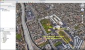
Exactly and the Google Earth is good source for such data.
But one of my the mission planner issues is impossibility to set negative AGL heights. For example I cannot fly around a valley from top of near hill lower than take off point + 10 m.
 
  • Like
Reactions: autelBill
Other than using a sextant and trigonometry, a topo map is probably the closest you can get to being able to determine ground elevation at waypoints. The sectionals are sparse in this regard except when depicting obstructions.
Thank you a great suggestion which answers my question, I have found that there are topo maps available online. Another poster has suggested google earth which I will also try later - not quite sure where in google earth I can find this info.
 
Exactly and the Google Earth is good source for such data.
But one of my the mission planner issues is impossibility to set negative AGL heights. For example I cannot fly around a valley from top of near hill lower than take off point + 10 m.
I've not used the mission planner yet, but didn't a recent firmware update provide the ability to use MSL altitude? Would that be applicable to your situation?
 
But one of my the mission planner issues is impossibility to set negative AGL heights.
I've read this before but never tested it. with just the RC AC can I fly "below" my take off? ( start at the top of a hill and fly down into the flat land)
 
I flew a mission earlier this evening with numerous waypoints. I set the altitude to 180 feet for all waypoint and return to home set also at 180 feet to keep everything consistent.

The problem was by time it got to one of the furthest away waypoints it was only circa 50-80 feet above actual ground level. What caused this was the land gradient sloped upwards causing a steady decrease in actual drone height. As the ground level increased the drone did not sense this and adjust its height accordingly.

As far as I am aware you can't tell the slope of the land through a standard top down satellite view so I am relying on the drone to adjust its height so it is always at the height I specify.

So my question is have I missed something and how does the Evo calculate its real-time height - I would have thought it would sense the ground getting higher and adjust its height to compensate but clearly this has not happened.

Any thoughts or advice?
Above sea level?
 

Latest threads

Members online

No members online now.

Forum statistics

Threads
11,290
Messages
103,017
Members
9,900
Latest member
Barry.bain