Welcome, Autel Pilots!
Join our free Autel drone community today!
Join Us

Emlid Caster VS Local NTRIP

DD requires at least 4 points

It works great with RTK and no points at all, and here is one I did with a minimum of 4 checkpoints.
Why is the report in "inches" with the scale in "meters" ? I'm a licensed PLS since 1985. I don't understand why the project can't be set to one type of measuring unit. Mixing units is dangerous, we don't use inches and meters together.

I'm new to the UAS world and just learning, hoping to take the part 107 test soon. I'm leaning towards DD but pix4d is interesting. I've learned a lot just being on the forum. A lot of knowledge here !
 
  • Like
Reactions: jmason702
Why is the report in "inches" with the scale in "meters" ? I'm a licensed PLS since 1985. I don't understand why the project can't be set to one type of measuring unit. Mixing units is dangerous, we don't use inches and meters together.

I'm new to the UAS world and just learning, hoping to take the part 107 test soon. I'm leaning towards DD but pix4d is interesting. I've learned a lot just being on the forum. A lot of knowledge here !
Welcome to the forum.

Drone Deploy does this with a lot of different items. They mix and match measurement systems on the report, in the Explore Tool and even in the Elevation Calibration. It frustrates me to no end. But Drone Deploy does have some incredible sharing and integration tools.

Check out Metashape also it can do some interesting things too and you get full control of your processing from just using default settings to as deep as you are willing to learn and experiment with.
 
My trial is running out on meta shape, is there a tool? like a marker, you can put on the map and it gives you your coords and elevation at that point?
Use the Draw Shape dropdown. Choose Point. Place the point. Right click on the point. Measure.
Or just add a marker depending on what you are trying to do. Markers don't have to be GCPs or CPs. They can just be points.
 
Yeah, welcome Bryan!

I'm sure you will be leveraging the heck of drones in a short time.

When I jumped into this about 2016, I was fortunate to have a couple of PLS guys that were quick into UAS and photogrammetry willing to help me get started. They both did a lot of work evaluating SFM processors and ended up primarily using Agisoft for what that's worth. It turns out it is also the least expensive.
DD is best at sharing projects to a large group of people. But the general vibe of the company is "We don't need you, You need us" kind of thing. (See @jaja6009 s comment). So take that into consideration.
 
  • Like
Reactions: EBEPLS
Yeah, welcome Bryan!

I'm sure you will be leveraging the heck of drones in a short time.

When I jumped into this about 2016, I was fortunate to have a couple of PLS guys that were quick into UAS and photogrammetry willing to help me get started. They both did a lot of work evaluating SFM processors and ended up primarily using Agisoft for what that's worth. It turns out it is also the least expensive.
DD is best at sharing projects to a large group of people. But the general vibe of the company is "We don't need you, You need us" kind of thing. (See @jaja6009 s comment). So take that into consideration.
Yep, I'm learning a lot from you and others here and on Emlid forum. We've got a possible big ALTA project in the works, we are planning to sub out the photogrammetry work (SAM). The client wants LIDAR with orthomosaic. They're balking at the cost, but I'm thinking we'll get it. This is the 3rd proposal in 2 years. I'm curious in the processing of the flight data; a contact with SAM who'll be doing the field work does the processing also. He said I could look in when he processes (if we get the project).


Changing the subject, I've got the EVO II PRO RTK back in November (for my 65th birthday) . I was looking at the RTK use and am wondering..... why can't you just input your NTRIP credentials in the app and go. Of course there
would be GCP's set and measured like we always do for the photogrammetrists.

I'll try your field method with my RS2 this weekend, seems easy but the question above puzzles me.

Thanks for your help and the others here on the forum. I'll try to contribute when my brain is active !
 
Last edited:
Changing the subject, I've got the EVO II PRO RTK back in November (for my 65th birthday) . I was looking at the RTK use and am wondering..... why can't you just input your NTRIP credentials in the app and go. Of course there
would be GCP's set and measured like we always do for the photogrammetrists.
Are you referring to using NTRIP straight to the Explorer App (via a hotspot) in comparison to using Emlid's Local NTRIP? Both are fine. The advantage to using Local, is that the baseline to the project area is as short as it can be without a good VRS network. Mainly, it just removes the chance of a hiccup in the cell service during the time flying, which depending on the project can be significant.
 
  • Like
Reactions: EBEPLS
Sounds good, I'll try both. I always have a least 1 base locally onsite when surveying (sometimes 2 mostly, as I've always harped on Emlid). With two bases I can PP every point located with a closed loop

This will be a test for "Javad Justin 3" to PP all the image locations with two bases on site. I haven't decided on the image processing software yet. Probably going with your suggestion Dave.
 
  • Like
Reactions: jmason702
Sounds good, I'll try both. I always have a least 1 base locally onsite when surveying (sometimes 2 mostly, as I've always harped on Emlid). With two bases I can PP every point located with a closed loop

This will be a test for "Javad Justin 3" to PP all the image locations with two bases on site. I haven't decided on the image processing software yet. Probably going with your suggestion Dave.
You can get a fully functional 30 day trial of Metashape. I'm not sure about DD or Pix4D.
 
You can get a fully functional 30 day trial of Metashape. I'm not sure about DD or Pix4D.
Bought AgiSoft Metashape yesterday, really looking forward to using. I watched a bunch of YouTube and read the online manual, felt comfortable buying it. I bought the node locked version. Appears fairly easy to use while playing with the trial version a couple of nights on my 5 yr old work station (64gb ram, Nvidia card).

I've got two 3 year old really fast work stations, both have Nvidia cards, ones got 128gb ram; not sure about the other.

Looking to plan a small mission (5-10ac), it's got a lot of relief and another small site the same but a lot of boulders. I've got 4 batts; been alternating all and averaging about 30-35 minutes on each.

The buds on the trees/bushes are starting to bust out, a couple of weeks they'll be full out. Bradford pair trees already blooming.
 
Appears fairly easy to use while playing with the trial version a couple of nights on my 5 yr old work station (64gb ram, Nvidia card).

I've got two 3 year old really fast work stations, both have Nvidia cards, ones got 128gb ram; not sure about the other.
You should be fine. MS likes VRAM too for some processing. Up to 1000 Evo images should be no problem at all. When you get your workflow dialed how you like it, you can load your images, add your markers and adjustments as necessary. And then add all of the products you want to extract in a Batch Workflow queue and let it go on it's own while you do something else.
 
  • Like
Reactions: EBERLS
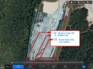
Whats the relative mission altitude? I'm planning the flight level at 200' AGL per the mission planner on the SC. Its well above the treeline. Is this in case of obstacles ? Manual and search on forum doesn't reveal much info about the use.
 
Whats the relative mission altitude? I'm planning the flight level at 200' AGL per the mission planner on the SC. Its well above the treeline. Is this in case of obstacles ? Manual and search on forum doesn't reveal much info about the use.
Firstly, always remember that the Altitude elevation you set is going to be relative to your take-off point. Not MSL or anything else.

In Autel Explorer, Relative Altitude is where you can set the difference in elevation between the Take-off point and the subject area, if there is significant difference. Unfortunately, in Explorer, it is useless. If you set an elevation difference in the Relative Height field, the app will display the Actual AGL that the drone will be over subject, but that is it.

What the setting is actually for, and actually does in other flight control applications, is also adjust the # of flight lines and images to achieve the desired overlap based upon the setting you specify. For example. If you set 200' AGL, but you are flying over terrain that is 100' above your take-off elevation, the drone will actually be 100' above the subject. So, if you have overlap set at 80/75 for 200', you are going to get significantly less overlap if the drone is actually only 100' above the subject. In other apps, if you set the Relative Altitude( sometimes called and "offset height") the app will adjust the overlap (and sometimes speed) to achieve your specified requirements at the resulting AGL over the subject. In Autel Explorer, it does not do that. At least not on my v.2 . So, you just have to adjust the overlap setting directly yourself to account for any significant elevation change.

a.jpeg
 
  • Like
Reactions: EBEPLS
Thanks Dave, you the man ! !

I was thinking that was the case, controller base will be at top of hill. My neighbors are harvesting "pine trees" and the loggers have basically clear-cut several adjoining tracts (+300 acres).

I'm planning to just map a small area (approx 5 acres) at the head of a drainage hollow, it has good relief and easy to drive to. If I have time, I'll place some GCP's (paint dots on tree stumps) and try flying with RTN parameters set directly on smart controller. I may have time to locate the points with my Javad or RS2. I may even try to use RS2 as local RTN hook up. We got LIDAR data for all the state, it'll be a good benchmark for MS to compare with.

In any case, I'll set my other Javad on control mark at house also. The area I'm planning to map is about 1/2 mile from my house base.

This all depends on weather. NWS is calling for 20% chance of rain. If that's the case, I'll wait till a sunny, light wind day.

I don't want to get my baby wet... electronics and moisture don't mix well !
 
  • Like
Reactions: Dave Pitman
Bought AgiSoft Metashape yesterday, really looking forward to using. I watched a bunch of YouTube and read the online manual, felt comfortable buying it. I bought the node locked version. Appears fairly easy to use while playing with the trial version a couple of nights on my 5 yr old work station (64gb ram, Nvidia card).

I've got two 3 year old really fast work stations, both have Nvidia cards, ones got 128gb ram; not sure about the other.

Looking to plan a small mission (5-10ac), it's got a lot of relief and another small site the same but a lot of boulders. I've got 4 batts; been alternating all and averaging about 30-35 minutes on each.

The buds on the trees/bushes are starting to bust out, a couple of weeks they'll be full out. Bradford pair trees already blooming.

I think you will like Metashape, especially being a PLS. It can do so much more than simple orthos and point clouds. I have just scratched the surface of it.

My favorite part is the Reference Panel. For me it is such a simple yet powerfule interface to express what Datum/PCS you want to output in, what GCS the images are in and what GCS/PCS the markers (Control Points) are in. And then also let you use either ellipsoid or local geoids.

The other things I like are way too much to list.

Emlids units, an Autel or DJI RTK drone and one of the photogrammetry structure from motion appications are very powerful yet economical tools.

Please share whatever you are able to with data and workflows as I am extremely interested in these from a PLS, as this can only help myself and others make better outputs.

I always try to compare to our state's LIDAR data. COVID-19 though put a stop to it, hopefully they will restart as I absolutely love the free data.
 
  • Like
Reactions: EBEPLS
Will do jaja6009. I think the system I've got now is pretty good, thanks to this forum and others.

One reason I got MS was Dave and doing a lot of homework. I liked playing around with it a couple of nights. I'm hoping I'll get a smooth workflow up and running-cant use commercially yet not having an unmanned license but I'm studying.

Carlson software has a package with the EVO II and their processing software but it's kinda pricey at $11K. I've got about $8800 in the EVO and MS. We've got other Carlson software for work and it's great software, but I like MS. Yep, I like the reference panel for CS, that's what impressed me the most. They have an excellent manual from what I've read so far.

We check our state's LIDAR basically every day whether by terrestrial or GNSS traverse doing our projects at work. It's amazing how accurate it is on undisturbed ground (road intersection, top of large boulders, in wooded areas, etc).

Thanks for everyone's help and advice ! Hopefully I'll be able to help others
 
  • Like
Reactions: jmason702

Latest threads

Members online

Forum statistics

Threads
11,280
Messages
102,953
Members
9,878
Latest member
Elio-Italy