

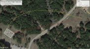
For more dramatic drone video, I use a log-spiral curved flight path. I generate the waypoints and use DroneLink to produce the mission plan.
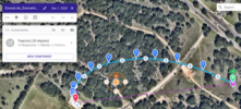
See attached images. First, there's the waypoints generated; and second is the mission produced using DroneLink.
Benefits: a) There's no need to move the camera since each log-spiral curve has a characteristic constant tangent angle. b) There's a much more diverse view perspective. c) Only two geographic points are required to define the log-spiral curve [one point at each end] - although several waypoints are generated to define the curved flight path.

")


