- Joined
- Sep 9, 2023
- Messages
- 40
- Reaction score
- 13
- Age
- 37
I found a procedure to use QGC and google earth to prep a kml file for a mission but ive had no luck.
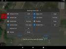
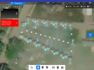
i get the mission to import to explorer but after setting the height to msl and setting timelapse and gimbal angle the mission produces no images when flown and the altitude of flight is 200' rather than 80' as set in QGC.
anyone actually figure out terrain following with QGroundControl? I'm stumped
following the procedure in this video: KML file posted by Porites
Last edited:


