- Joined
- Sep 27, 2022
- Messages
- 10
- Reaction score
- 5
- Age
- 36
Hello everyone, firts of all I want to say thank to Ameth Vargas, creator of
video (you can follow him as @amethjosevargascampo2855) who tell me the first details to create MSL flight.
Everyone can use his guide to create flight msl planning mission but we need to correct something. The first time when I create one mission to stay 100 metters above terrain I realice than I only get 54 metters. This is because we need to add the ellipsode heigth in our area.
Right after obtain a KML file from QgroudControl, we just open it with Nopetad and whe only need this.
You need to delet everything out of this lines.
Now need to calculate the Ellipsoidal height and replace it in the KML, we can use a free calculator like Geoid Height Calculator | Software | GAGE or software like Leica Infinity where we can add our ellipsoidal model.
After the transformation, replace your data in the KML, put it in your phone and open it, now you can continue the tutorial of Ameth Vargas at 7:20.
WHAT I DO
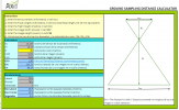
After realice the mechanism of the KML I use a AutoCAD with a free DTM 5 metters pixel of my flight zone, over it draw my flight plan using a modded PIX4D Ground Sampling Distance Calculator Sheet to calculate the distance gap and other parameters. See attach files.
Assign Vertical DTM data to the vertices of my drew plan, then plus the flight height, export the coordenates, import to Leica Infinity to convert it to Ellipsoidal height and put them in the KML file, open it in the smartphone, select Waypoint, edit, gimbal at 90º and MSL, take pictures every 2-3 seconds, save and start to flight, easy-pease.
I hope this help someone. Bye
Everyone can use his guide to create flight msl planning mission but we need to correct something. The first time when I create one mission to stay 100 metters above terrain I realice than I only get 54 metters. This is because we need to add the ellipsode heigth in our area.
Right after obtain a KML file from QgroudControl, we just open it with Nopetad and whe only need this.
<?xml version="1.0" encoding="UTF-8"?>
<kml xmlns="[URL]http://www.opengis.net/kml/2.2[/URL]" xmlns:gx="[URL]http://www.google.com/kml/ext/2.2[/URL]" xmlns:kml="[URL]http://www.opengis.net/kml/2.2[/URL]" xmlns:atom="[URL='http://www.w3.org/2005/Atom']Atom Syndication Format namespace[/URL]">
<Document>
    <name>NAME-YOU-WANT-TO-USE-TO-YOUR-FLIGHT-PLAN</name>
    <Placemark>
        <name>Flight Path</name>
        <LineString>
            <tessellate>1</tessellate>
            <altitudeMode>absolute</altitudeMode>
            <coordinates>
COORDINATES IN FORMAT LONGITUDE,LATITUDE,ORTHOMETRIC HEIGHT
</coordinates>
        </LineString>
    </Placemark>
</Document>
</kml>
You need to delet everything out of this lines.
Now need to calculate the Ellipsoidal height and replace it in the KML, we can use a free calculator like Geoid Height Calculator | Software | GAGE or software like Leica Infinity where we can add our ellipsoidal model.
After the transformation, replace your data in the KML, put it in your phone and open it, now you can continue the tutorial of Ameth Vargas at 7:20.
WHAT I DO
After realice the mechanism of the KML I use a AutoCAD with a free DTM 5 metters pixel of my flight zone, over it draw my flight plan using a modded PIX4D Ground Sampling Distance Calculator Sheet to calculate the distance gap and other parameters. See attach files.
Assign Vertical DTM data to the vertices of my drew plan, then plus the flight height, export the coordenates, import to Leica Infinity to convert it to Ellipsoidal height and put them in the KML file, open it in the smartphone, select Waypoint, edit, gimbal at 90º and MSL, take pictures every 2-3 seconds, save and start to flight, easy-pease.
I hope this help someone. Bye
Attachments
Last edited:


