While 90% of my work is mapping, we have a landmark we're unfortunately going to be bulldozing and I've been asked if there's a way to memorialize it in some way. I'd like to have more than just a few pictures, I'd like to do a full, and high-quality 3d map of the building. My problem is that I haven't found a good way to accomplish this: does anyone here have an idea of how to pull this off?


You are using an out of date browser. It may not display this or other websites correctly.
You should upgrade or use an alternative browser.
You should upgrade or use an alternative browser.
Modeling with E2 Enterprise?
- Thread starter goldenu2
- Start date
D
Deleted member 8818
Guest
This comes to mind:While 90% of my work is mapping, we have a landmark we're unfortunately going to be bulldozing and I've been asked if there's a way to memorialize it in some way. I'd like to have more than just a few pictures, I'd like to do a full, and high-quality 3d map of the building. My problem is that I haven't found a good way to accomplish this: does anyone here have an idea of how to pull this off?

Professional photogrammetry and drone mapping software
A unique suite of photogrammetry software for drone mapping. Capture images with our app, process on desktop or cloud and create maps and 3D models.
 www.pix4d.com
D
Deleted member 8818
Guest
Also this:
 www.dronegenuity.com
Aerial Photogrammetry - Create 3D Models With Drone Photos - dronegenuity
New software tools turns drone photos into 3D models. Here's how to create a 3D model with your drone & how 3D models are transforming industries.

I guess I should have been clearer: I use DroneDeploy, and I can turn out a 3d map, but the quality is quite poor. I was thinking more like Pix3d's modeling capabilities.Also this:
Aerial Photogrammetry - Create 3D Models With Drone Photos - dronegenuity
New software tools turns drone photos into 3D models. Here's how to create a 3D model with your drone & how 3D models are transforming industries.
D
Deleted member 8818
Guest
Then I think you're thinking correctly, and with more clarity than I am.I guess I should have been clearer: I use DroneDeploy, and I can turn out a 3d map, but the quality is quite poor. I was thinking more like Pix3d's modeling capabilities.
") Good luck.
Good luck.michael2002
Active Member
- Joined
- Dec 24, 2020
- Messages
- 28
- Reaction score
- 13
- Age
- 46
Although Pix4D is much easier to use, I have found that agisoft metashape generally produces better and more detailed 3D models. But I think it is all personal preference.
michael2002
Active Member
- Joined
- Dec 24, 2020
- Messages
- 28
- Reaction score
- 13
- Age
- 46
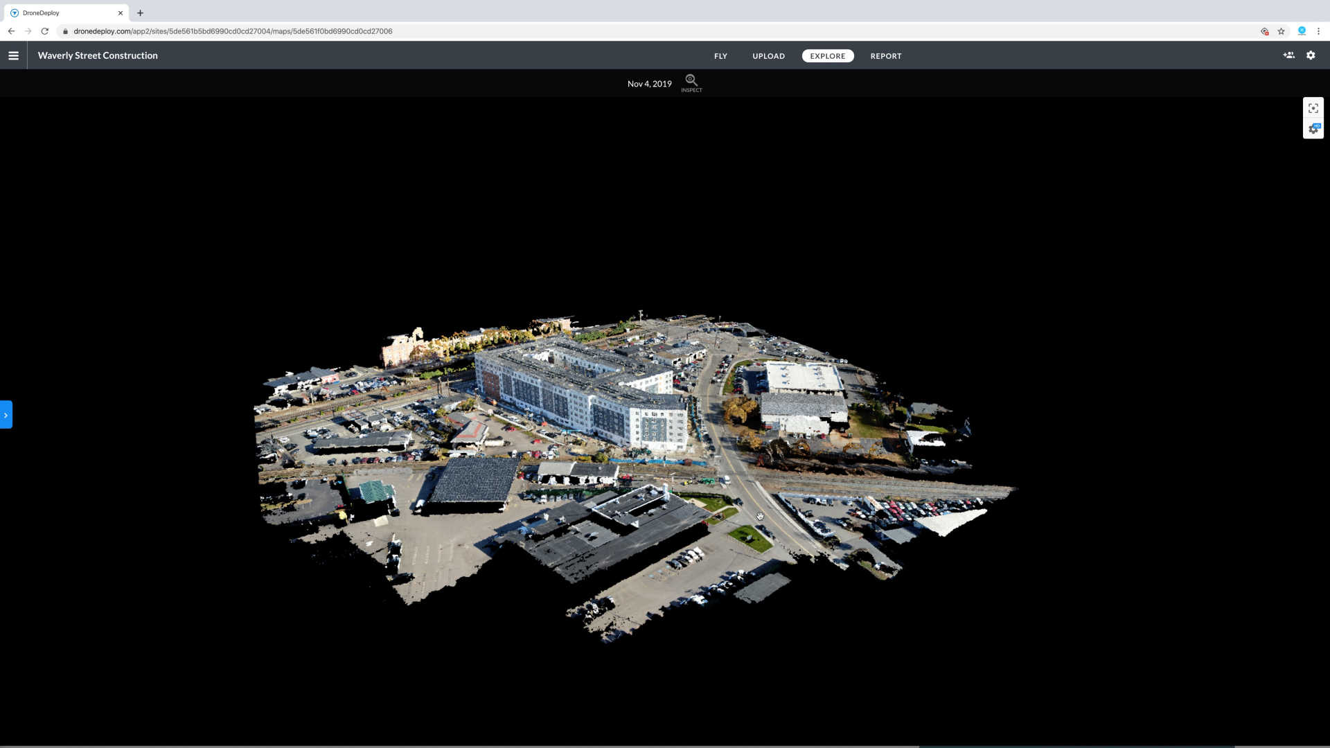
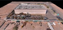
That is a pretty impressive model. What height did you fly and how many photos did you have? Was it nidir or oblique? How big was the dense cloud?I think DD does a great job if you fly the mission correctly... That goes with any software
michael2002
Active Member
- Joined
- Dec 24, 2020
- Messages
- 28
- Reaction score
- 13
- Age
- 46
Did you do this with an Autel unit? I thought that autel was not supported in dronedeloy.Nadir and Oblique, I think the average was 90 ft AGL since the area was small
Dave Pitman
Well-Known Member
If you want to go for incredible, Metashape also has flight planning capability to produce the finest model. Of course, currently you would need to use your DJI craft to fly it.
Yes... EVO PRO RTKDid you do this with an Autel unit? I thought that autel was not supported in dronedeloy.
Do you know of any good online training courses for Metashape?If you want to go for incredible, Metashape also has flight planning capability to produce the finest model. Of course, currently you would need to use your DJI craft to fly it.
michael2002
Active Member
- Joined
- Dec 24, 2020
- Messages
- 28
- Reaction score
- 13
- Age
- 46
No, I used autel mission planner and manual flying. 50% auto and 50% manualDid you use the dronedeploy mission planning with the Autel RTK? So DD supports it now?
michael2002
Active Member
- Joined
- Dec 24, 2020
- Messages
- 28
- Reaction score
- 13
- Age
- 46
Ah ok, so you just imported the images into drone deploy. Thank you!No, I used autel mission planner and manual flying. 50% auto and 50% manual
Similar threads
- Replies
- 6
- Views
- 2K
- Replies
- 0
- Views
- 1K


Latest threads
-
-
Onocoy NTRIP. Has anyone tried this set up for RTK drone survey (photo mosaic and 3D capture and generation).
- Started by HorusQcopter
- Replies: 0
-
-
-