Awaiting for some panorama mode in EVO II, I am very impressed the quality of 360 panorama made manually.
There are so many details on the horizontal line.
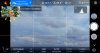
The stitched panorama from EVO II PRO has native 26.650 pixels.
I do 360/180 panoramas for 8 years. Since the Google Street View started.
For last 3 years I do panoramas from drones too.
From me, recording all necessary photos in some automatic way it is a key feature for drone software.
I mean: recording collection of photos, not stitching photos to one panorama image.
Because, end to end, we want to stitch photos in some more advanced mode in 3rd part software.
This is what I do:
1. Select some average sunlight frame to adjust the best manual expose shutter iso and aperture.
This is important because we have to collect all photos with the same expose conditions.
Making 360 panorama we always look forward and backward to sunlight, and expose changes.
We have to select some compromise. I usually select the frame with the sun on the top-right corner and horizontal line in the middle.
But this is depend from the weather, number of clouds, time of day.
2. Switch all expose parameters to manual. Observe histogram.
3. Set camera tilt angle to 0 degrees.
4. Set drone orientation at the beginning, to north, or one of 90 degrees. It will make easier rotation. Observe the map preview and drone red arrow.
5. Record 12 photos around by turning the drone 5 degrees approximately. +12 photos.
I do so by observing the drone red arrow on the map preview.

6. Change camera tilt up to 25 degrees. Repeat point 5. +12 photos
7. Change camera tilt down to 25-30 degrees. Repeat point 5. +12 photos
8. Change camera tilt down to 50-60 degrees. Repeat point 5. +12 photos
10. Change camera tilt down to 90 degrees. Record 2 photos with rotation 90 degrees. +2 photos
Together it gives a collection of 50 photos.
YOU HAVE TO RECORD ALL 50 as fast as it is possible. Because sunlight moves, because clouds fly, because cars and people moves.
With a matter of practices, it can be done in less than 10 minutes (it requests around 10 seconds for every drone rotation and photo shooting).
Well, maybe this not too long.
Using another drone, which can shoot all photos in automatic mode, it gets in 5 minutes.
Then I stitch all photos in 3rd part software. You can easily get Google search answers what you can use.
Certainly EVO II cannot tilt the camera up to 90 degrees to, so called zenith photo.
There will be empty circle on the top of panorama. You must paint it manually, or use approximation of closer photos.
But there are always sky and clouds. 99% of panorama viewers want to see details on the ground.
(There is only one other drone on the market, who can record zenith automatically, but it has worse camera than EVO II)
The samples of result:
Olsztyn. City. 360 Panorama | 360Cities
Polane. Olsztyn. The city beltway. 360 Panorama | 360Cities
Just do not watch panoramas in default zoom, see details by zooming the view.
If you have own better mode to make 360 panoramas with EVO II, please share your way.

There are so many details on the horizontal line.
The stitched panorama from EVO II PRO has native 26.650 pixels.
I do 360/180 panoramas for 8 years. Since the Google Street View started.
For last 3 years I do panoramas from drones too.
From me, recording all necessary photos in some automatic way it is a key feature for drone software.
I mean: recording collection of photos, not stitching photos to one panorama image.
Because, end to end, we want to stitch photos in some more advanced mode in 3rd part software.
This is what I do:
1. Select some average sunlight frame to adjust the best manual expose shutter iso and aperture.
This is important because we have to collect all photos with the same expose conditions.
Making 360 panorama we always look forward and backward to sunlight, and expose changes.
We have to select some compromise. I usually select the frame with the sun on the top-right corner and horizontal line in the middle.
But this is depend from the weather, number of clouds, time of day.
2. Switch all expose parameters to manual. Observe histogram.
3. Set camera tilt angle to 0 degrees.
4. Set drone orientation at the beginning, to north, or one of 90 degrees. It will make easier rotation. Observe the map preview and drone red arrow.
5. Record 12 photos around by turning the drone 5 degrees approximately. +12 photos.
I do so by observing the drone red arrow on the map preview.
6. Change camera tilt up to 25 degrees. Repeat point 5. +12 photos
7. Change camera tilt down to 25-30 degrees. Repeat point 5. +12 photos
8. Change camera tilt down to 50-60 degrees. Repeat point 5. +12 photos
10. Change camera tilt down to 90 degrees. Record 2 photos with rotation 90 degrees. +2 photos
Together it gives a collection of 50 photos.
YOU HAVE TO RECORD ALL 50 as fast as it is possible. Because sunlight moves, because clouds fly, because cars and people moves.
With a matter of practices, it can be done in less than 10 minutes (it requests around 10 seconds for every drone rotation and photo shooting).
Well, maybe this not too long.
Using another drone, which can shoot all photos in automatic mode, it gets in 5 minutes.
Then I stitch all photos in 3rd part software. You can easily get Google search answers what you can use.
Certainly EVO II cannot tilt the camera up to 90 degrees to, so called zenith photo.
There will be empty circle on the top of panorama. You must paint it manually, or use approximation of closer photos.
But there are always sky and clouds. 99% of panorama viewers want to see details on the ground.
(There is only one other drone on the market, who can record zenith automatically, but it has worse camera than EVO II)
The samples of result:
Olsztyn. City. 360 Panorama | 360Cities
Polane. Olsztyn. The city beltway. 360 Panorama | 360Cities
Just do not watch panoramas in default zoom, see details by zooming the view.
If you have own better mode to make 360 panoramas with EVO II, please share your way.