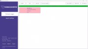
I was looking into this with the EXIF TOOL, the Reason being to work with RAPTOR MAPs, the Thermocoverter App works great to get you 640T IRG file to a FLIR file, but some info in metadata is missing, due to it is in the Meta Data of the JPEG straight out of the drone. (yall, pitch, roll, GPS accuracy, etc..) Because this info is not in the IRG file, it's in the JEPG out of drone file
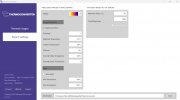
THIS IS FOR MAPPING ONLY! Thermocoverter is all you need to do ALL your work in FLIR Tools. and probably may work in mapping software like PIX and DD (just need someone to test it) But for RAPTOR MAPs I feel we may need to combine the METADATA using the EXIF Tool, is a Lil over my head, to be honest, but I do know it can be done and can be done in a fast-acting batch file.
Hope this makes sense, and this is just my thoughts on it, I sent in some test data to Raptor Maps, waiting for a response.