Welcome, Autel Pilots!
Join our free Autel drone community today!
Join Us

What maps does Autel use for flight restriction warning?

Skadee

Active Member
Joined
Nov 8, 2020
Messages
25
Reaction score
5
Age
53
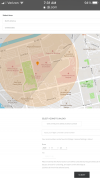
So I had a flight restriction warning today, in an area not restricted by the FAA, and I check Airmap or Kittyhawk prior to flight.

What database or resources does Autel use for its flight restriction map?

I realize its just a warning, but its still unnerving to see. I couldn't find anything online, and the warning doesn't indicate what area is restricted, as far as I can tell.
 
I'd like to know as well, what data they are pulling from, except I was in restricted airspace with authorization when I was lit up with alerts in Explorer and the controller giving an ominous "altitude restricted" message.

If you do not mind me asking, what were your coordinates? Please feel free to IM me them if you don't want them in the open.
 
Last edited:
Nothong to hide, try this -
39°45'53" N 86°10'16" W

I watched a video of a guy with a restriction similar to what your describing, but he didn't have authorization, then clearly busted altitude. Unfortunately, he's a popular drone pilot in NYC.
 
You have Riley’s and Eskenazi Hospital a very short distance from the coordinates you provided. Eskenazi is a Trauma Center. Both hospitals have very active helipads. Indianapolis International isn’t too far to the southwest of your location as well.1DBF3DB4-9F06-4784-9AF8-959CA0395200.png
 
Correct, but this is not in "restricted" airspace, no authorization is required in this area, simply maintaining clearance from any other traffic. Controlled airspace surrounds the international airport you've described, "restriction" would start at 10nm radius starts at 2100 AGL, and my point is still a few miles NE of that.

I agree with you, Airmap shows the radius around the helipad, and the stadium radius overlaps the same area, but to that same point, the stadium restriction is only in place during sporting events, as would the speedway if flying farther west.

Granted, the software likely assumes worst-case.
 
I would assume the software is detecting the airport and helipads and just warning you of their presence. Luckily Autel does not restrict you like DJI and completely lock your ability.
 
Don't completely quote me on this but first, initial look, it appears Autel is using Airmap.
 

Latest threads

Members online

Forum statistics

Threads
11,229
Messages
102,663
Members
9,821
Latest member
Bigmaxsg