- Joined
- May 6, 2022
- Messages
- 176
- Reaction score
- 111
- Age
- 50
#DJwhatOne of the best I have seen YET! RMSE a little over 1/2"
#DJwhatOne of the best I have seen YET! RMSE a little over 1/2"
Hey @cegio, thanks for the detailed response! The only way we are going to gain a voice with a company like this is to push as a community particularly when it is isolated to a specific sub-model or piece of software. Those are little fish to them. If there was a common failure across the entire Evo II line or all the devices with RTK then it would be dealt with more expeditiously but at the level we are at now bugs become very obscure, especially when there cannot consistently be reproduced.you can specify the firmware that you use in the enterprise with the RTK module, like many, I am having countless problems when using this drone in photogrammetry, I have already reported a lot of failures to autel china but it is like talking to a wall . Luckily Ken a week ago gave me an older firmware and an older app, WiMaxPad_FW_V2.2.5.zip, is it the same one you are using? I am going to leave here the problems / suggestions that I communicate to them in the wechat support group.
all this was reported in February
1. Improve the support service, we have been claiming some antennas for a smart controller v2 for 4 months that fell after only 1 hour of use. I know you're on it, but you must do it faster
2. When there is a problem with the rtk service provider and the drone loses the FIX state in the RTK connection, the main screen still shows FIX, but if you enter the RTK configuration, you can see how it is disconnected, for some reason. For this reason, the connection status is not updated on the main screen.
3. It would be a good idea if you included the option to save several connection profiles to different RTK service providers, currently every time you move to another city, or even in the same city but changing provider, you have to delete your data from provider of the RTK service of the last flight and put the new ones, if you included a kind of profile store it would be great, it would be a little faster for the client.
4. Include more flight modes and utilities for photogrammetry, such as linear mission or Terrain awearness
5. Using the smart controller (I don't know if it happens with the standard remote control too), when doing a waypoints mission imported in kml, when it loses radio signal and recovers it again, you have control of the drone through the transmitter, but the app does not respond to any instructions, you see the camera image in the small square of the app, but on the main screen you see the loading icon, and it may take 5 or 10 minutes for the app to link again with the drone, sometimes the mission ends and the app is still not linked correctly. When this happens, it seems that the mission remains unfinished and if you try to start that mission again, when launching the mission in the app it appears as if it was doing the mission, but the drone has not even taken off.
6. Eliminate the pauses at each point of the waypoint, currently, in missions by waypoint, the drone stops to perform the action, this in photogrammetry is a significant waste of time, the drone stops even if you have the FLYOVER option checked in the waypoint mission.
7. Currently to receive the differential corrections for the RTK you depend on having telephone coverage and data connection so that through the Wi-Fi shared by your phone for example, the smart controller receives those corrections, you can also use your own gps station to send the corrections also through the internet. But there is another way, and that is that your own GPS station sends the differential corrections directly via Wi-Fi, without the need to have telephone coverage or a data connection, by connecting the smart controller to the Wi-Fi of the GPS station, well, this option does not work , this option is necessary in environments where there is no mobile phone coverage.
8.Problems with file numbering, the same numbering is repeated in different folders on different flights on the same day, it does so randomly and does not continue with the numbering of the previous folder, making those photos unable to be dragged into the program since they already They exist under that name.
9. the drone is doing a mission, it is on its way correctly, but on the screen it shows the wrong position, it is jumping from the position in which it is to another in which the drone is not
10. During the waypoint mission, when it reaches a point, the camera goes to 0º and goes down again to -90º, leaving that photo completely useless.
11. Randomly, the mission duration information becomes ascending instead of descending, ie the time is increasing instead of decreasing. And this does it well sometimes and other times it changes in the middle of the mission.
and from the latest firmware...
the few things that worked well have stopped working, in the imported KML missions. 4 out of 5 fail, the mission starts and at the third or fourth point it shows the mission finished message, and the worst thing is not only that, it is that the drone remains standing there without saying anything else, or going home or anything.
It does not generate RINEX files, since the last firmware it has stopped doing it.
loss of photos during the mission
sometimes it doesn't fly along the mission line but along a parallel line
and nothing mentioned in February has been solved, how are you dealing with these problems? They have a great machine but the software leaves a lot to be desired and this is costing us money. The response from autel is null, so as always we only have users to support each other, so everything in my power to help, count on me.


Thank you for your answer, regarding point 7, to cast with the emlid, you still need a data connection on your mobile phone to share them with the antenna, in caster mode, the emlid receives the corrections from a server that it accesses using your data connection, and in the smart controller you put the data to connect to the connection created by the emlid. What I mean is to create this connection without the need for the emlid to connect to any server, this function can be used with the phantom 4 pro RTK, but not with the evo 2 RTK.Hey @cegio, thanks for the detailed response! The only way we are going to gain a voice with a company like this is to push as a community particularly when it is isolated to a specific sub-model or piece of software. Those are little fish to them. If there was a common failure across the entire Evo II line or all the devices with RTK then it would be dealt with more expeditiously but at the level we are at now bugs become very obscure, especially when there cannot consistently be reproduced.
Just to clarify I am using the Smart Controller so the latest F/W is v1.0.77.1 and the AC (aircraft) is v.2.3.8 which is also the latest. Our AC was not bound to the SC when it came and the only way I have been able to get them to is to use SC F/W 1.0.77.1. @Dave Pitman provided me with some older F/W which broke the connections again but it was the first F/W flash on the AC that I actually saw progress on the screen, tones from the AC and a reboot of the AC. The F/W that resided on the AC was obviously outdated and previous attempts to flash v2.3.8 were unsuccessful. Once the older AC F/W completed I was then able to successfully flash AC F/W v2.3.8 and everything is working except for the few software bugs and the dropping if the drone which you can see actually occurred twice on this last mission.
View attachment 14044
View attachment 14045
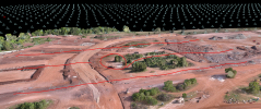
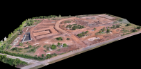
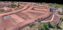
This model looks amazing and the accuracy report was good but not quite as good as I have seen in the past. One thing to keep in mind though that with any measurement system the larger the measurement the more error you will see so the accuracy on a 10ac site is going to "look better" than the 73ac site.
View attachment 14043
View attachment 14046
As to your statements...
- This is the number one problem in this industry right now and always will be until there is a change in culture of how the business interacts with its users. The obviously have a vision that they put out there according to there satisfaction but when it comes down to the nitty gritty that users like us experience and can help with there is a common theme I see in Engineering across industries that when they think they are done then they are done and have moved on to the next project. I understand that a budget on a project may have been exhausted and it's time to reap profits but these types of scenarios will eventually lead to decline and possible failure. This is what happened to Yuneec is the USA. They want to have a presence but without attentive support and Engineering it is not sustainable. These are tools in our professional lives and we have limits as to what costs we can incur helping them make their product successful (Yuneec and Autel).
- This is a good point and something I picked up on immediately. The status will change on the shortcut bar but it is delayed. Instead, if there is a weak data connections and/or non-optimal satellite connectivity I have to be diligent about flying by site so I can keep the RTK Status window open as much as possible.
- I only need one connection profile but more importantly I need it to maintain during AC reboots. Almost every other piece of GNSS equipment that we use with an NTRIP connection and interface persists because the simple connection is on the controller/data collector. The one exception besides the Evo are the Emlid Reach receivers. Their software is on the device so there connection state matches the hardware state.
- 100% the first thing I noticed because the first contract we are trying to get is a county park and 3 county roads. Obviously the roads require corridor flight and the park needs terrain awareness.
- I haven't experienced anything like this so far.
- Agreed!
- Corrections via "Wi-Fi" is actually more specifically over a protocol called LoRa. I think a better way to do this is the local Emlid Caster.
- Yes, they need to add another digit to the file naming, as does every other manufacturer but at least they could add a "2" to the file names in the next folder. Seems like it would be easier to just go to the 1,000's.
- Haven't seen this so far.
- I noticed this on a standard waypoint mission. I was using it to perform the best corridor flight I could and the camera likes to look up at each vertice. Luckily none of the images were caught in between the movement.
- This is typical as it is weighting the budget against the actual use and will fluctuate, particularly in the wind.
- Our KML's generated through CAD work fine but we have had a couple of KML's created in Google Earth fail.
- We also have an issue with no logs.
- Have not "lost" photos per say but have seen uneven spacing.
- I think I saw this happen one time where the completed flight line was slightly offset from the planned alignment but it has not been an issue consistently.
I only deal with it through perseverance and an associated budget. As with any tech solution your budget should include some R&D time or it will be much harder to progress and when that value is reached (as it was with the Yuneec RTK) it's time to move on. Part of R&D is beta testing and I have been participating in at least two at all times over the last 7 years. This project has about a 6-7 week window left before Autel starts hearing from corporate.
Our main points of pain as of today.
The only way we are going to get through this in a timely manner is to get enough user that experience any of these issues to band together and push. Documentation is key to holding them accountable in the event that they don't want to participate.
- Dropping of the aircraft
- NTRIP disconnection
- Poor parametric flight configuration which IMO opinion is leading the incorrect shutter firing issue
- No corridor flight or terrain following
You're probably looking for the offline NTRIP caster then.Thank you for your answer, regarding point 7, to cast with the emlid, you still need a data connection on your mobile phone to share them with the antenna, in caster mode, the emlid receives the corrections from a server that it accesses using your data connection, and in the smart controller you put the data to connect to the connection created by the emlid. What I mean is to create this connection without the need for the emlid to connect to any server, this function can be used with the phantom 4 pro RTK, but not with the evo 2 RTK.
about point 12, we are using the UGCS mission planner because it allows you to create missions in environments with different heights, respecting the fixed height to the ground

 www.linkedin.com
Let us know what you find out please...You're probably looking for the offline NTRIP caster then.

Setup of an offline NTRIP caster for drone RTK applications using Emlid's GNSS Reach RS2
A common RTK configuration requires either a manufacturer specific base station or an online NTRIP caster. Manufacturer-specific solutions have the advantage that they work even if Internet connectivity is unstable or non-existent; on the other hand, they mean an additional investment for a GNSS stawww.linkedin.com
Definitely checking out UGCS. I didn't like it the first time we tried to run it but different drone and different need needs now.
UGCS is now working with Autel?
I wonder if it is compatible with all models of the Evo II...
Wonder if my rtk V1 will work. It does on map pilot proAt the moment with evo 2 only the UGCS online mission planner works, I leave you a tutorial on how to use it.
the reason we are using UGCS precisely is that map pilot is not compatible with evo 2 enterpriseWonder if my rtk V1 will work. It does on map pilot pro
Thank you for that! Is Map Pilot?the reason we are using UGCS precisely is that map pilot is not compatible with evo 2 enterprise
Is Map Pilot compatible with the Enterprise?what do you mean?
Is Map Pilot compatible with the Enterprise?
Gotcha, thanks. You better believe I am going to be pestering DroneDeploy...no, as I mentioned before, that is the reason why we are using the UGCS online mission planner, because map pilot is not compatible with the evo 2 enterprise.
Wonder if my rtk V1 will work. It does on map pilot pro
PLEASE DO!Gotcha, thanks. You better believe I am going to be pestering DroneDeploy...
What sucks about this is that DDE (Map Pilot) is more than happy to support the Enterprise model. It is our now old problem of Autel not caring what in the current SDK is not seeing the Enterprise craft. Kind of like how Autel ignores the problem with whatever is causing the failure with Emlid Local NTRIP. Both of these are most likely very tiny coding issues that could be fixed very quickly....if Autel wanted to. Very frustrating.the reason we are using UGCS precisely is that map pilot is not compatible with evo 2 enterprise
We use essential cookies to make this site work, and optional cookies to enhance your experience.

