You are using an out of date browser. It may not display this or other websites correctly.
You should upgrade or use an alternative browser.
You should upgrade or use an alternative browser.
Evo 2 V2 how to connect with ntrip host
- Thread starter jmathews
- Start date
Number 1, you'll need an account and log in credentials with them for sure.Hi guys, could you please help me to connect with a ntrip host in Utah? Thank you
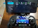
You can use your phones hotspot and enter your credentials in the Autel Exploit app in the settings menu under RTK. It'll tell you whether or not you have logged in correctly. If you are logged in correctly, the app will give you an accuracy result either float, single or fix solution in the bottom of the RTK menu.
You'll want a fix solution if you are doing any mapping. Also, if you have the RTK function on, the Evo won't launch unless it has a fix solution. So make sure you have a clear view of the sky at your home point if you have the RTK option on.
When I'm just flying around my house (I have mostly trees and bushes in my yard), I'm not able to get a fix solution before launching. With the RTK option off and after my flight check, I'll launch the Evo to about a 50-100' AGL above the tree canopy and then activate the RTK option and wait until I have a fix solution then proceed to fly around or start my mapping mission. The Autel app is kinda intuitive... there's not much in the manual but I've learned a lot just playing around with it and reading the forum here for help.
I've had my Evo II Pro RTK V2 since November 2022 and I really enjoy flying and practicing mapping small sites. You'll need a good image processing software for your mapping missions. I've bought Agisoft Metashape Pro and it's great software. The software has a steep learning curve if you get into the fine details of mapping but it's pretty easy to get started using Agisoft's support website.
I'm also studying for the part 107 exam. It's not as easy as I thought it would be. My problem is finding the time due to work and other responsibilities.
Good luck !
Thank you so much for your response, ok already got Autel explorer and my credentials for the app, I've been doing some missions to learn more about this drone and it's awesome, but I don't know how to use the rtk option, what should I do first? Just turn on the hotspot? Where do I see or who do I ask for that information about server, port and mountpoints? Is it a service that is paid separately? the manual says about an rtk network but that doesn't workNumber 1, you'll need an account and log in credentials with them for sure.
You can use your phones hotspot and enter your credentials in the Autel Exploit app in the settings menu under RTK. It'll tell you whether or not you have logged in correctly. If you are logged in correctly, the app will give you an accuracy result either float, single or fix solution in the bottom of the RTK menu.
You'll want a fix solution if you are doing any mapping. Also, if you have the RTK function on, the Evo won't launch unless it has a fix solution. So make sure you have a clear view of the sky at your home point if you have the RTK option on.
When I'm just flying around my house (I have mostly trees and bushes in my yard), I'm not able to get a fix solution before launching. With the RTK option off and after my flight check, I'll launch the Evo to about a 50-100' AGL above the tree canopy and then activate the RTK option and wait until I have a fix solution then proceed to fly around or start my mapping mission. The Autel app is kinda intuitive... there's not much in the manual but I've learned a lot just playing around with it and reading the forum here for help.
I've had my Evo II Pro RTK V2 since November 2022 and I really enjoy flying and practicing mapping small sites. You'll need a good image processing software for your mapping missions. I've bought Agisoft Metashape Pro and it's great software. The software has a steep learning curve if you get into the fine details of mapping but it's pretty easy to get started using Agisoft's support website.
I'm also studying for the part 107 exam. It's not as easy as I thought it would be. My problem is finding the time due to work and other responsibilities.
Good luck !
Regards my friend
You do need a real time network provider for the RTK if you are not using a separate base station. We use Smartnet but it is a yearly subscription of $2400. You can find your local state DOT networks which I know here in MA is free. The stations in the MADOT are spread out and not as dense as Smartnet, but it gets one going with RTK. Utah should have a similar setup.
Is the drone outside? Unfortunately, RTK network services only work outside with clear sky. The drone RTK will need to receive the corrections from the network through the smart controller but still needs clear open visibility to the satellites.
Similar threads
- Replies
- 7
- Views
- 3K
- Replies
- 5
- Views
- 459
- Replies
- 17
- Views
- 1K
- Replies
- 0
- Views
- 564


