Sometimes when mapping the drone will fly in a straight line but cockeyed, if you get what I mean. Have you guys noticed this and is there a fix?
Yes, I did compass calcs...
Sometimes when mapping the drone will fly in a straight line but cockeyed, if you get what I mean. Have you guys noticed this and is there a fix?
Yes, I did compass calcs...
Do you mean the horizon is not level? It could be due to a strong crosswind, possibly a crosswind that you do not feel on the ground, or you might want to try a gimbal calibration. It is also possible that where it took off was not perfectly level. A final possibility is that it is just off and you need to straighten the horizon in post. I have had to straighten the horizon in post at times for every drone I've ever owned.
Translate for not-native english talking guys....
Do you mean the drone does not keep the gimbal straight to the point where is heading?
Because this is from Mission planner, you can set there everything, even some that you do not wish ))).
On last missions i made, I have not noticed this, all was straight, but another thing appeared: the drone is not flying on route with MAPS, but have a paralel movement, like 2 meters from the line that was put in Google maps...is having same route, but is moved like 2-3 meters from what was set. Also in Mission shows the line of movement from drone to be paralel to one set in Mission but at 2-3 meters distance.... No clue why.
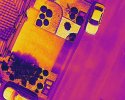
I think what he is talking about is that it is yawing whilst flying in a straight line. I have noticed this with an Inspire 1, 2 and a Mavic Pro and Pro 2. All of these flights were using DroneDeploy. My guess is that it makes the photos easier to stitch together. Maps turn out great.
Have seen something similar, are you running open or closed grid on your missions?
Have also seen this with DD (DroneDeploy) on DJI products when during part of the mission it is getting some sideways off center, not straight down (NADIR) and not quite oblique angles.
How did your images from your mission process? Did you get the results expected, or where they distorted?
Also out of curiosity what was wind speed and direction as well as speed of aircraft? Flew mission yesterday at 200' at 9MPH which had good results.


") ))).
))).
