Welcome, Autel Pilots!
Join our free Autel drone community today!
Join Us

Orthophotogrametry Elevation Processing

jf121

Active Member
Joined
Sep 1, 2022
Messages
25
Reaction score
1
Age
38
Per the responses to my thread about Altitude Errors, I now understand that the elevation or 'altitude' of the drone and the images it captures are relative to the WGS ellipsoid. When I survey the ground control points, the xyz are in State Plane Ft with z = feet above NAVD88. I am using agisoft metashape to process the survey data. I keep getting very poor results.

Understanding that the elevations of the cameras (photos) are relative to WGS, I specify the reference system for my cameras as WGS (meters). When I load in my xyz control points I specify that they are in stpft, with elevations in feet.

Is this the correct way to process data? It seems as though agisoft does not realize that the altitude is relative to the WGS ellipsoid - it seems to assume that the elevation datums are the same.

P.S. I dont recall having this issue with my DJI Phantom II
 
Is this the correct way to process data? I
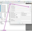
You are close. In metashape import your photos. Metashape will recognize the crs based on the image exif data. Align the photos.Next, before you import your control points, convert the cameras to the crs used for the points.
Now when you import your points and specify the crs (which now matches the cameras) you should be good.

3.jpg
 
Last edited:
  • Like
Reactions: mauricioranzan
Dave,

I still don't think that is solving my problems. I am aware that I have to set the camera reference as WGS 84 and my makers (in my case) to NAD83 / Delaware (ftUS). If I change the Coordinate System of the project, it does not convert the cameras to my desired coordinate system. It merely prescribes the value of latitude and longitude to Northing and Easting (ft) with conversion:

e.g. Longitude = -75.4 --> Easting (ft) -75.4

If I use the convert tool, it does, in fact, convert from WGS to State Plane feet. However, the vertical datum is still the ellipsoid, not NAVD88. Does optimizing the alignment perform the transformation? If so, the RTK is essentially useless since I still need dense GCPs.

Thanks,
 
I realized that I have to modify the State Plane feet coord system to the NAVD88 datum after viewing the following tutorial:


However, I do not have a NAVD88.gsf file so I cannot make the conversion.

Also, what geoid does autel use, (12, 12A, 18?)
 
A more simple and straightforward approach may be to correct the actual vertical offset by applying the offset to the image exif. It is very easy with an app called Redtoolbox. There is a free trial to see if it works for you. Or track down the appropriate geoid model to import into Metashape.

 
Dave,


This video helped me understand my issue:


However, I require a .tif or other raster that represents the conversion to NAVD88. Is there such a raster available? And from where?


For now, I am converting the GCP to the ellipsoidal height using values found using the NGS's tool assuming the Geoid is 12A . . .
 
Geoid models are just a tool, all produce NAVD88 orthometric heights when applied to the the NAD83 ellipsoid heights. Each ground model is keyed to a specific NAD83; realization. The latest would be NAD83(2011) and Geoid18.

In all but a few locations in the USA which I believe were specifically the Gulf Coast area, Geoid 12Aband 12B we're the same, I know that to be true in my part of the world in the PNW.

I assume you were NOT using a RTK drone or even PPK, otherwise you would already be corrected to NAD83 and a local geoid model.
 
I assume you were NOT using a RTK drone or even PPK, otherwise you would already be corrected to NAD83 and a local geoid model.
Hi Shelby.

It sounds like the OP is not using receiving NTRIP corrections on the drone. So, the elevation would indeed be referenced to wgs84 elipsoid. Then, he is using ground control referenced to state plane. Thus, the offset. That said, it is pretty easy to assign the geoid offset in Metashape if you know what it is on the project site.

Also, there are NTRIP providers in the US that are not using NAD83. But probably not many. I often use my own NTRIP base through a service provided by Emlid they call Emlid Caster, And in this case, the base is often set up on an averaged single point collected referenced to wgs84.

So, yeah, dealing with the elipsoid / geoid offset is not that uncommon.
 
Last edited:
Geoid models are just a tool, all produce NAVD88 orthometric heights when applied to the the NAD83 ellipsoid heights. Each ground model is keyed to a specific NAD83; realization. The latest would be NAD83(2011) and Geoid18.

In all but a few locations in the USA which I believe were specifically the Gulf Coast area, Geoid 12Aband 12B we're the same, I know that to be true in my part of the world in the PNW.

I assume you were NOT using a RTK drone or even PPK, otherwise you would already be corrected to NAD83 and a local geoid model.
Shelby,


I am using the EVO II Enterprise RTK (which is why I am posting in this section). I am connected to a Virtual Reference System (VRS), specifically, USACE/Keynet. It was my assumption that the RTK would return elevations orthometric heights. However, the altitude of the images in the .exif files are off by roughly the difference between the geoid and NAVD.

For now, I will continue adjusting my GCPs to the geoid elevation and then correcting it in post processing.
Unfortunately, I cannot access agiosoft webpages. Likely due to the fact it is a Russian company.
 
NTRIP corrections are going to in general be Latitude/Longitude/Ellipsoidal heights from any RTN in the USA. If working a small area, the Geoid model offset to NAVD88 is going to generally be a constant, HOWEVER, be aware that it really changes place to place, it can be feet different over a larger area. BEFORE adjusting to GCP's, it would be best if everything is in the final reference frame ie: NAVD88 generally in USA. In my work (mostly manned flights with a bit of UAV), we correct the aircraft data to NAVD88 and the GCP's to NAVD88 before running through processing of the images. I am not familiar with all the software for UAV image processing, BUT I would think same procedures would be good practice.

Since you used a correction service via receiving NTRIP corrections, your aircraft data is differentially corrected, BUT the heights in the EXIF data are ellipsoidal. If a small project, perhaps you could manually edit that data to NAVD88? NGS has tools for doing that. GEOID18 Interactive Computation | GEOID | Data & Imagery | National Geodetic Survey
 

Latest threads

Members online

No members online now.

Forum statistics

Threads
11,306
Messages
103,034
Members
9,916
Latest member
coastaldrone