Welcome, Autel Pilots!
Join our free Autel drone community today!
Join Us

geo reference data and shapefiles

Grant Rowe

Member
Joined
Sep 24, 2021
Messages
8
Reaction score
1
Age
63
Good day, i am a first time drone user in the forest industry in New Zealand. Most of the forest industry here use DJI, but i went with Autel because they get serviced here whereas DJI have to send to Australia to fix anything. I have a lot to learn. My work mostly requires that images get geo-referenced - I need to know where they are taken and show that to clients. I have worked out how to run rectangular and polygon missions to get images which can then be stitched to produce ortho photos. However, if I run a waypoint mission and take photos from various waypoints, I don't know how to easily extract photo locations (currently doing it manually by looking at the photo details and then capturing those co-ordinates, which is painfully time consuming). Ideally, the flight records should be able to be extracted from the explorer app and downloaded as shapefiles - can this be done ?

My next question will be if I can load up gpx or shapefiles to run a mission rather than "tap in" waypoints on the waypoint mission module in the explorer app.
Each (jpg) photo has embedded tagging by default.

I'll offer that we may have some semantics in play... "Geo-referenced" to me infers that you want higher accuracy, which could be achieved via RTK/PPK (and we're eagerly awaiting Autel to fix PPK), but you'll need an RTK model for this. If you simply want to "align" photos to a known point, there are a multitude of software packages that allow you to correct the embedded coordinates.

Unfortunately, there are no options such as Litchi for Autel, so no loading of waypoints from a desktop.
Thanks very much for your response. The accuracy of the Evo2 Pro without RTK is good enough for my current purposes, ie the co-ordinates I manually extracted from the jpg files are accurate enough. It would be really good if the flight records could be exported as either kml (google earth) or shapefiles - it is all in the cloud somewhere and shows up well in the explorer app, just to find it and export it?
 
Thanks very much for your response. The accuracy of the Evo2 Pro without RTK is good enough for my current purposes, ie the co-ordinates I manually extracted from the jpg files are accurate enough. It would be really good if the flight records could be exported as either kml (google earth) or shapefiles - it is all in the cloud somewhere and shows up well in the explorer app, just to find it and export it?
Are you wanting to create larger stitched orthos? or do you want to view individual images in Google Earth?
 
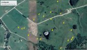
I just want to download locations from where I took individual photos and the flight path, something similar to this one done manually (but with the flight path as well, which other jobs may require)Google map Far Locations.jpg
 

Attachments

  • waypoint list.txt
    1.2 KB · Views: 5
I use an older app called geosetter for that. Since you also mentioned shapefiles, FME will convert km to shp.

Geosetter won't show a path, that's gettinto into some custom code, and I'm not a coder, but linking points sequentially based on time should be easy for those with the skills.
 
Thanks very much for your response. The accuracy of the Evo2 Pro without RTK is good enough for my current purposes, ie the co-ordinates I manually extracted from the jpg files are accurate enough. It would be really good if the flight records could be exported as either kml (google earth) or shapefiles - it is all in the cloud somewhere and shows up well in the explorer app, just to find it and export it?
I have loaded individual .jpgs directly from my SD card into ArcGIS, and the embedded coordinates allow the software to position the center of the image correct, but oriented incorrectly (e.g. north up, even if the drone was facing another direction----and then had to manually reorient each one. It worked, but was slow and only accurate in some parts of each photo..... I don't know of a way to export the waypoint mission as either a.kml or .shp which would definitely be a nice feature!
 
I have loaded individual .jpgs directly from my SD card into ArcGIS, and the embedded coordinates allow the software to position the center of the image correct, but oriented incorrectly (e.g. north up, even if the drone was facing another direction----and then had to manually reorient each one. It worked, but was slow and only accurate in some parts of each photo..... I don't know of a way to export the waypoint mission as either a.kml or .shp which would definitely be a nice feature!
Thanks Phil, I have managed to get the waypoints in via geosetter and the flight paths via the download sent by ne0031. There is also another thread called waypoints and POIs, or something like that which I will try to upload kml lines and polygons - I'll find it and put a link here for you if interested. This is all interesting stuff
 
Thanks Phil, I have managed to get the waypoints in via geosetter and the flight paths via the download sent by ne0031. There is also another thread called waypoints and POIs, or something like that which I will try to upload kml lines and polygons - I'll find it and put a link here for you if interested. This is all interesting stuff
 

Latest threads

Members online

Forum statistics

Threads
11,290
Messages
103,017
Members
9,900
Latest member
Barry.bain