Welcome, Autel Pilots!
Join our free Autel drone community today!
Join Us

640T and MAPPING

Wow, this is exciting news!!!

Unfortunately I went to the dark side on this and got the Phantom 4 RTK as I don't have time for Autel to fix the problems with the Evo 2 Enterprise and I have major mapping projects waiting for warmer weather.

This new feature should work with the P4RTK correct? As the P4RTK's GCS controller is what is receiving the corrections and then broadcasting to the drone?
in my thoughts, YES
 
I see you are on the Emlid forum. If Dirk is correct about port #s then Emlid will probably make something happen. If we have to wait for Autel to do something, well... probably won't happen.
Local Ntrip is working now with the new firmware 29 beta 3
 
  • Like
Reactions: jmason702
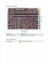
Refresh my memory. Is the 640T Autel's sensor or the Flir Bosun core? Map looks nice. What were your settings? Height, front/side overlap. speed?
Have done mapping with Autel EVO II (Pro and 8K) with autel mission, then upload to DD or ODM for processing, however have not done with 640T yet, curious to see how that would work and if it is viable. Couple of questions:

Assuming you flew mission with autel mission, then uploaded to DD for processing?

Can you elaborate on your mission settings, closed or open cross hatch (e.g. 3D)?

Overlap, altitude and speed of aircraft?

Thanks in advance.
 

Latest threads

Members online

Forum statistics

Threads
11,227
Messages
102,646
Members
9,818
Latest member
redwingaerials