Welcome, Autel Pilots!
Join our free Autel drone community today!
Join Us

Altitude negative 100 on the beach??

AirStag

Well-Known Member
Joined
Jun 27, 2020
Messages
133
Reaction score
56
Age
63
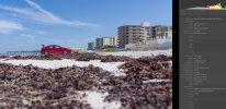
I flew at the beach last month, a thousand miles from home. I recalibrated everything when I got to the beach. My E2P is giving me altitudes at the beach of anywhere from -75 to -115 (viewing in LRC). What might cause that? Thanks for any feedback!
 

Attachments

  • ScreenHunter_2748 Jun. 19 11.43.jpg
    ScreenHunter_2748 Jun. 19 11.43.jpg
    601.2 KB · Views: 14
It sounds like your IMU was not calibrated for the new location. When you recalibrated everything are you certain that the IMU calibration process was successful? Since the display in the app shows AGL but the metadata stores ASL it is possible that the display while flying is still accurate even if the IMU thinks you are at a different elevation than you actually are in relation to sea level.

This is another pet peeve of mine that I listed in my DJI to Autel user experience thread. I would much rather that the AGL was stored in the metadata vs the ASL or at least store them both. ASL to me is not as important or as accurate as AGL. I doubt the ASL accuracy is as accurate as the AGL accuracy since technically AGL isn't even really AGL its really just a measurement from the takeoff point which I would imagine would be easier to measure than ASL.

As long as the drone flew as expected I wouldn't worry about it and would just chalk it up to another Autel quirk. I also would definitely not rely on it for any type of precision work. For precision work AGL / ATP (above takeoff point) is more important.
Thank you for the response @herein2021 !
I always assumed the AGL on the display was a calculation of ASL takeoff vs ASL live, but I agree it would be great to have both in the metadata.
I believe I calibrated the IMU, but maybe I missed it. I can't recall. I'll be back there in September so I'll try again and see what happens.
Best.

I believe you are correct, the displayed elevation in the app is based on the difference in takeoff ASL and current ASL....but, if the IMU thinks you are -100' ASL before you takeoff and the drone then takes off and flies +80' ASL, in the metadata for the image that was taken it will show -20' ASL while the display in the app will simply show 80' above takeoff point (ATP). ATP is not the same as AGL because in that same example you could be hovering over a 50' building which means your ATP is still 80' but your AGL is actually only 30' AGL and the whole time the IMU thinks you are -20' ASL if it thought you took off at -100' ASL.....fun stuff.
 
  • Like
Reactions: AirStag
Also, make use of Airdata as a check. It allows much more detail to be available to you than the App it seems. I have had lots of issues with altitude and it is not 'fun stuff'. I do surf photography and one cannot afford to have major inaccuracies in altitudes. Sure, things will never be perfect and one always has to be sensible so as not to ditch the drone but some of the inaccuracies are ridiculous. To be fair I have never had them as big as yours. My largest was 11m (maybe 35ft).

I don;t know what the answer is. Doing all the calibrations is obviously one aspect.
 
  • Like
Reactions: AirStag

Latest threads

Members online

No members online now.

Forum statistics

Threads
11,287
Messages
103,008
Members
9,898
Latest member
ghost183